Images and Project for the Landscape of Campania Region
-
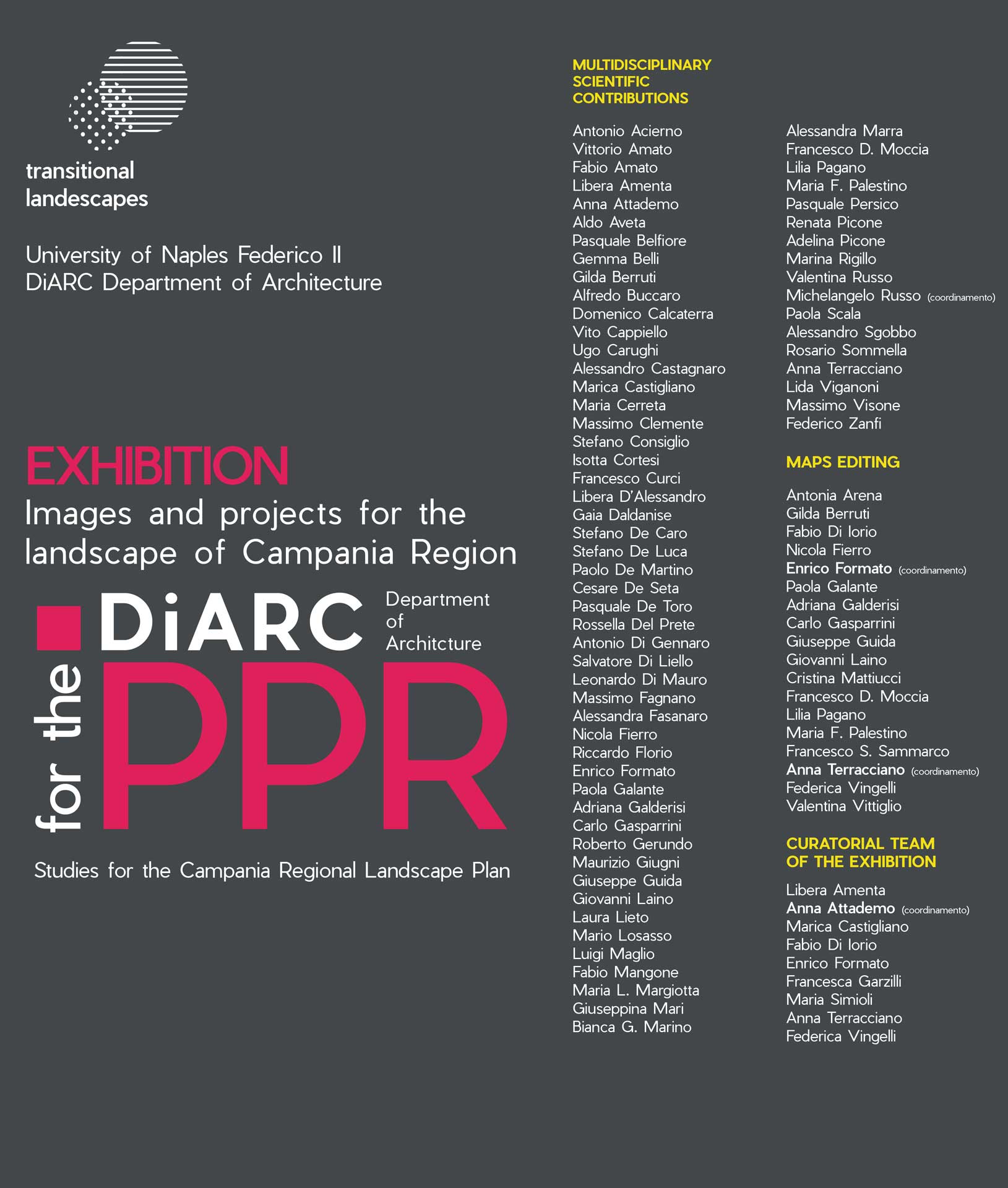
- University of Naples Federico II – DiARC Department of Architecture Exhibition – Images and projects for the landscape of Campania Region. Studies for the Campania Regional Landscape Plan PPR
-

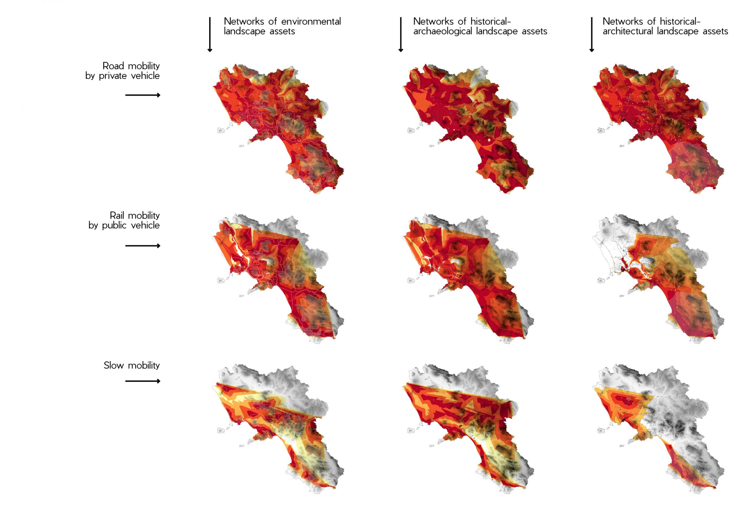
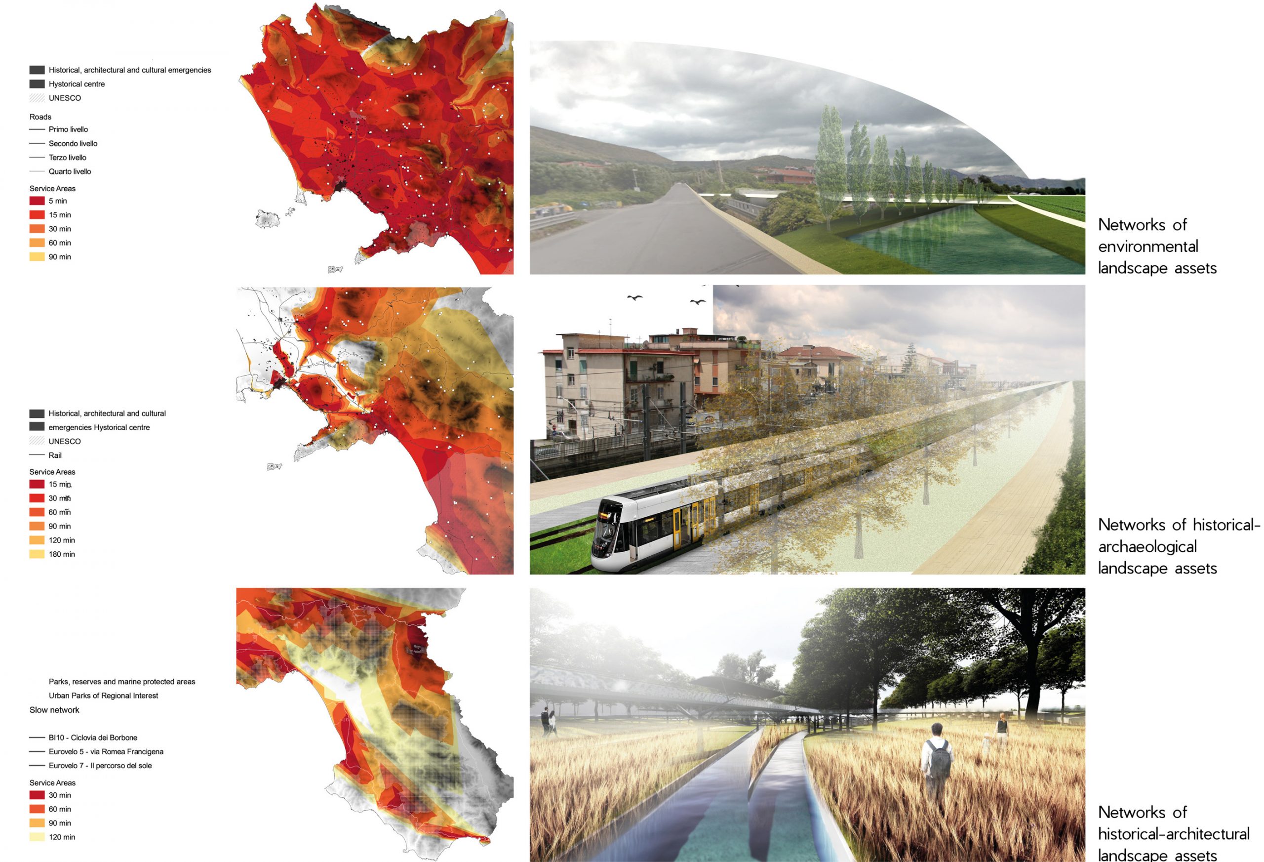
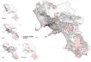
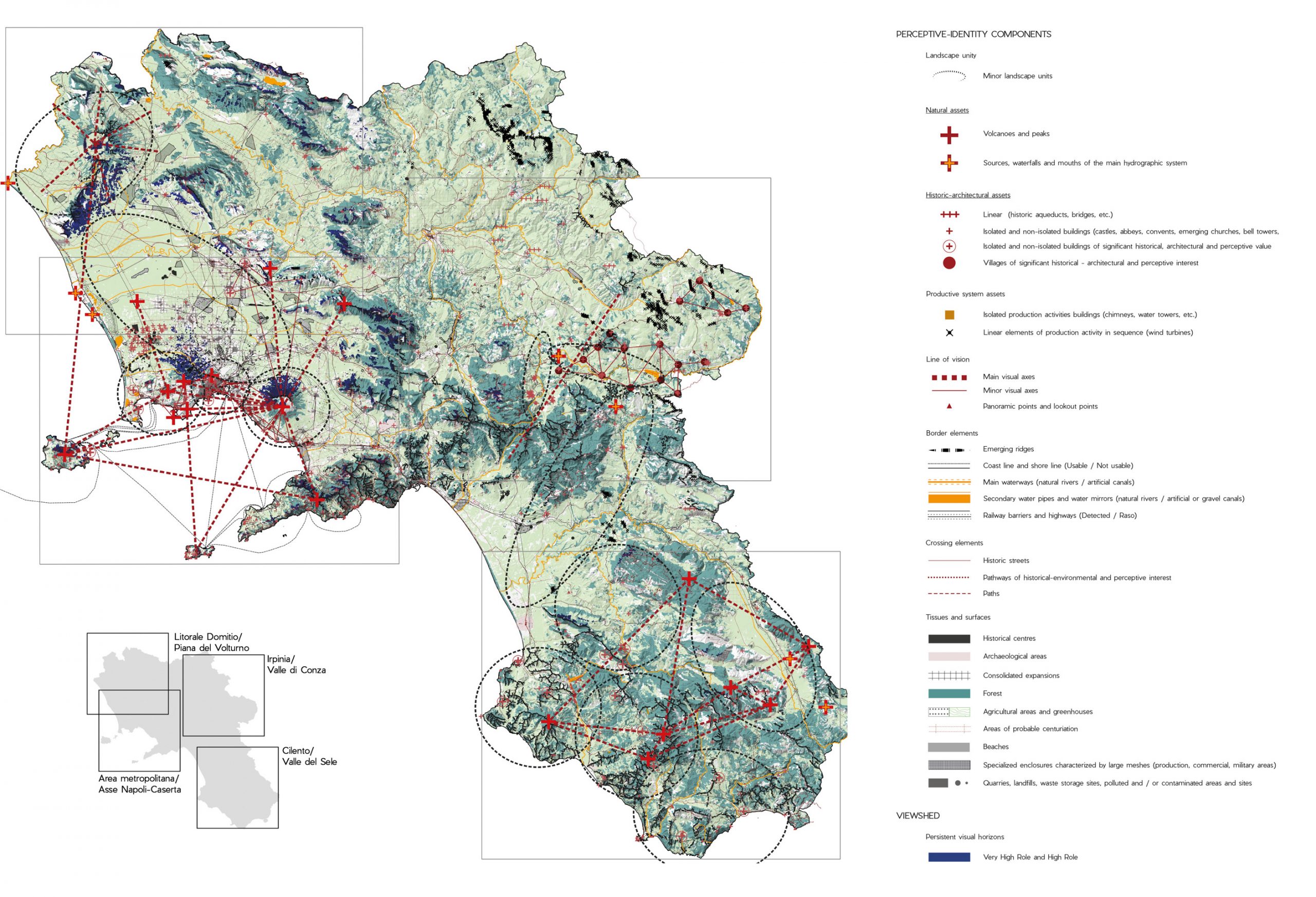
- DiARC C0.2 Accessibility. Mobility and landscape use networks – Campania, 2020
-
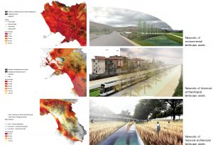
- DiARC – Regione Campania Accessibility to networks of historical-architectural landscape assets, 2020 – PiCTURES: n.1 and n,2 from top.Edited by Gabriella De Luzio. Master Degree in Architecture (DiARC) n,3 fom top. Edited by Clara chianese, Maria Teresa Ambrosio, Antonia Pizzo, Sara Ricciardi, Vincenzo Bozza, Marcello D’Antonio, Marilù Vaccaro, Agostino Danno, Luca De Simone, Andrea Di Lauro, Enrico Bianco, Alessio D’Ambrosio, Salvatore Di Sarno. Master Degree in Architecture (DiARC)
-
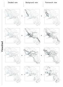
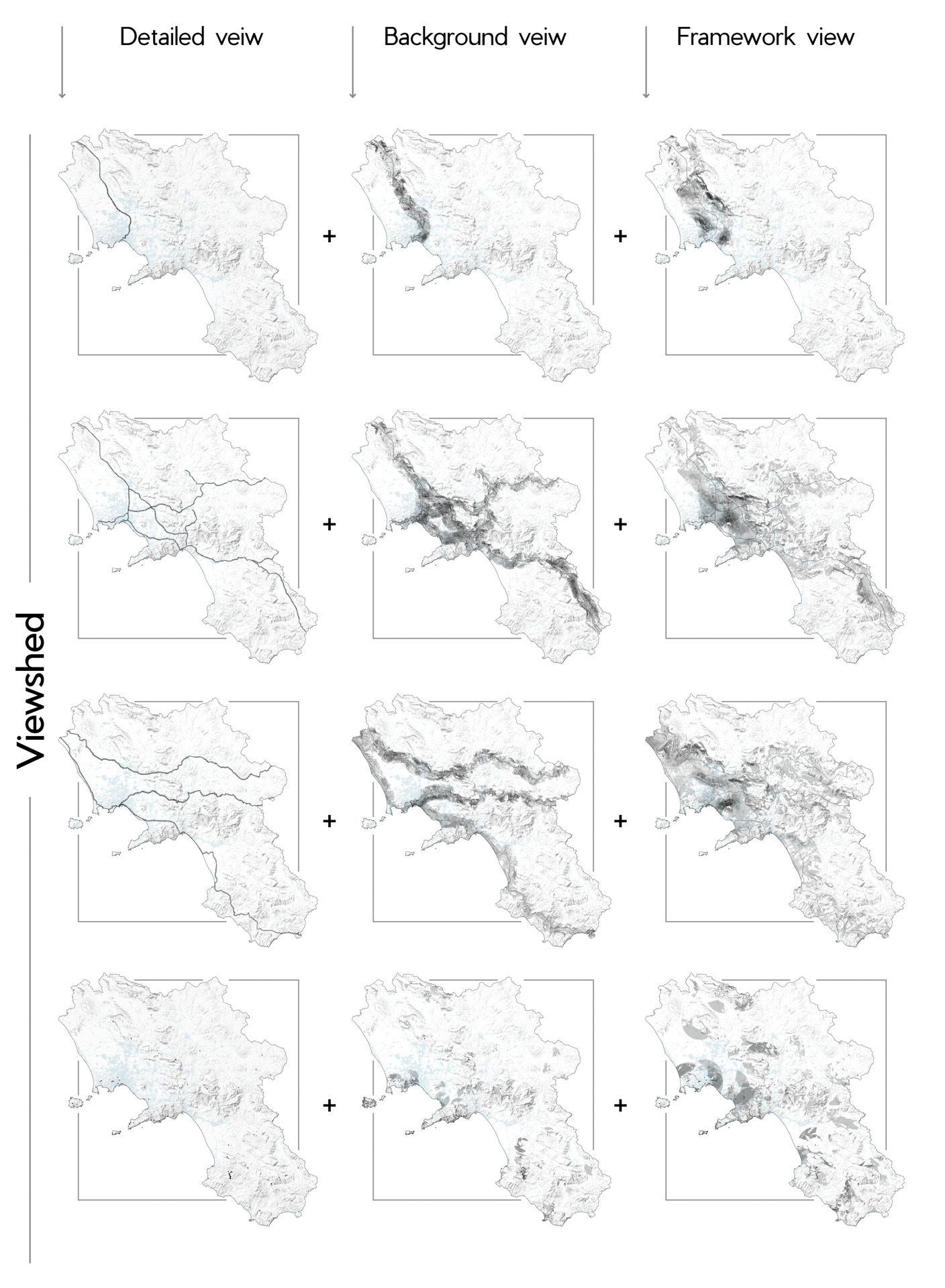
- DiARC – Regione Campania Viewshed analysis, 2020
-
- DiARC – Regione Campania Weighted intervisibility assessment , 2020 Edited by Diarc Team for Landscape Plan for Campania Region

-
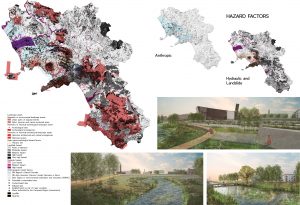
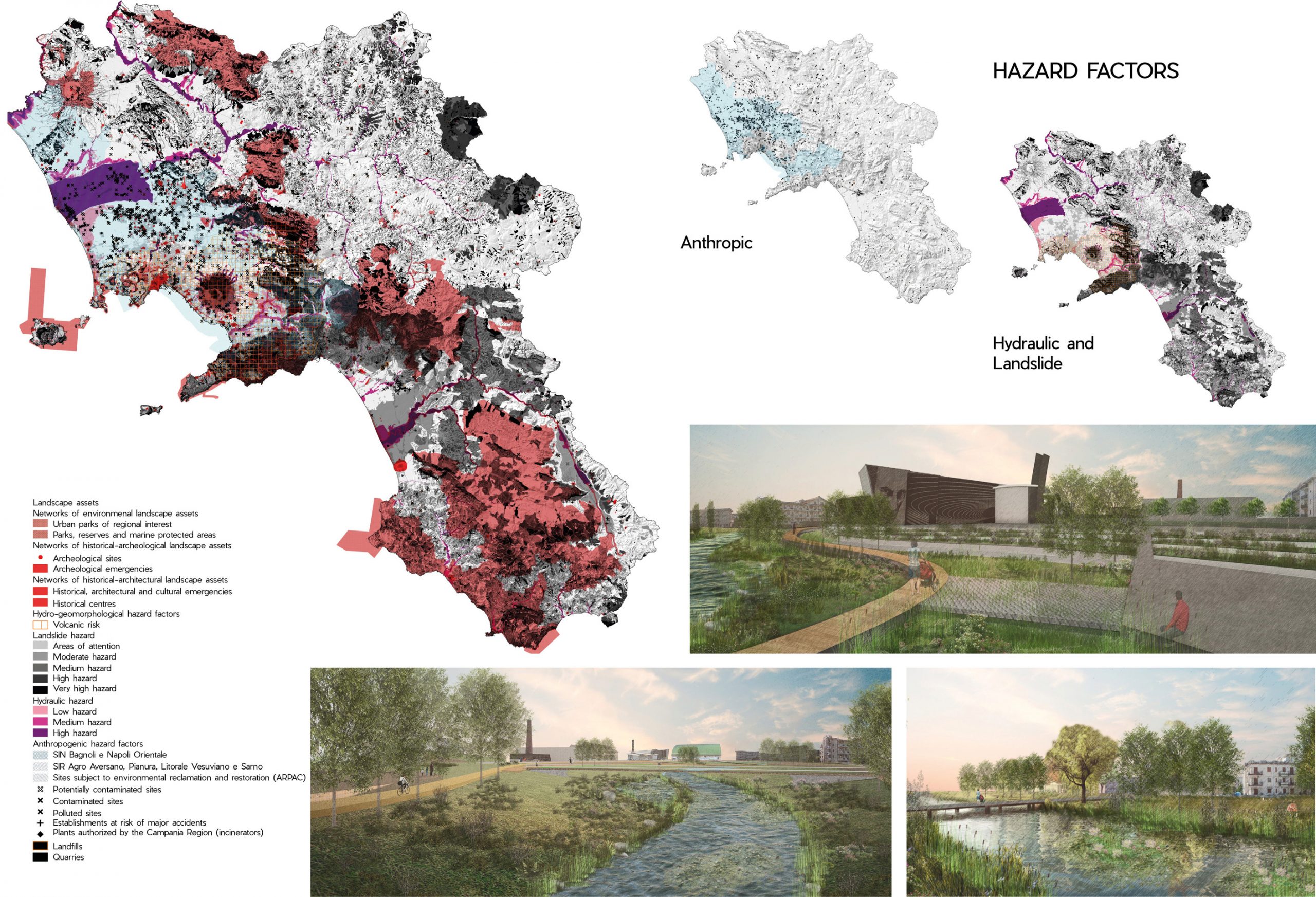
- Regione Campania Landscape hazard factors, 2020
-
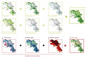
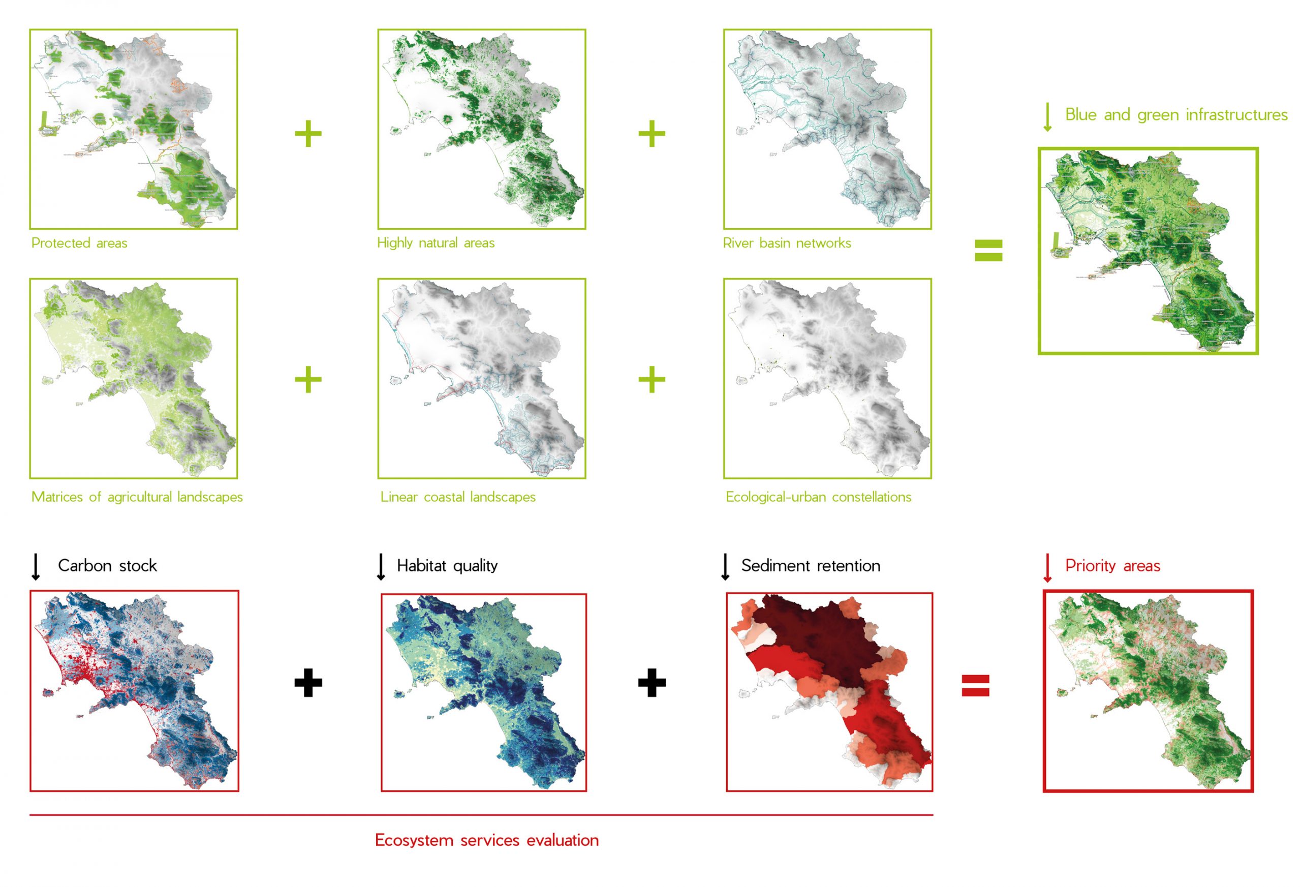
- Regione Campania Ecosystem services and connective potential, 2020
-
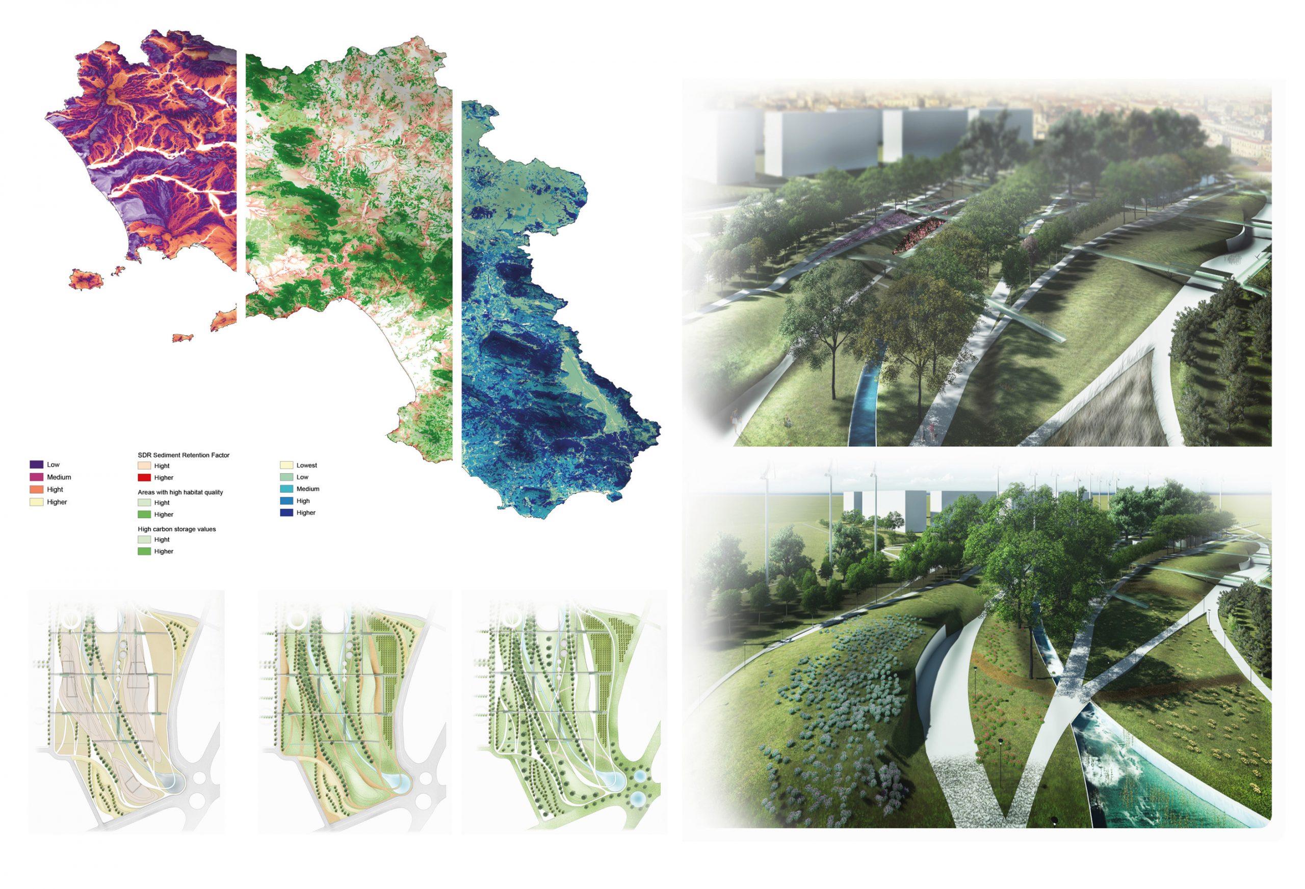
- Regione Campania SDR Sediment Retention Factor Priority areas for ecological conservation and reconnection Quality Habitat, 2020 MAPS: Edited by Diarc Team for Landscape Plan for Campania Region. PICTURES: “”Strategic Masterplan for Napoli Est”” edited by Enrico Bianco, Alessio D’Ambrosio and Salvatore Di Sarni. Master Degree in Architecture (DiARC)
-

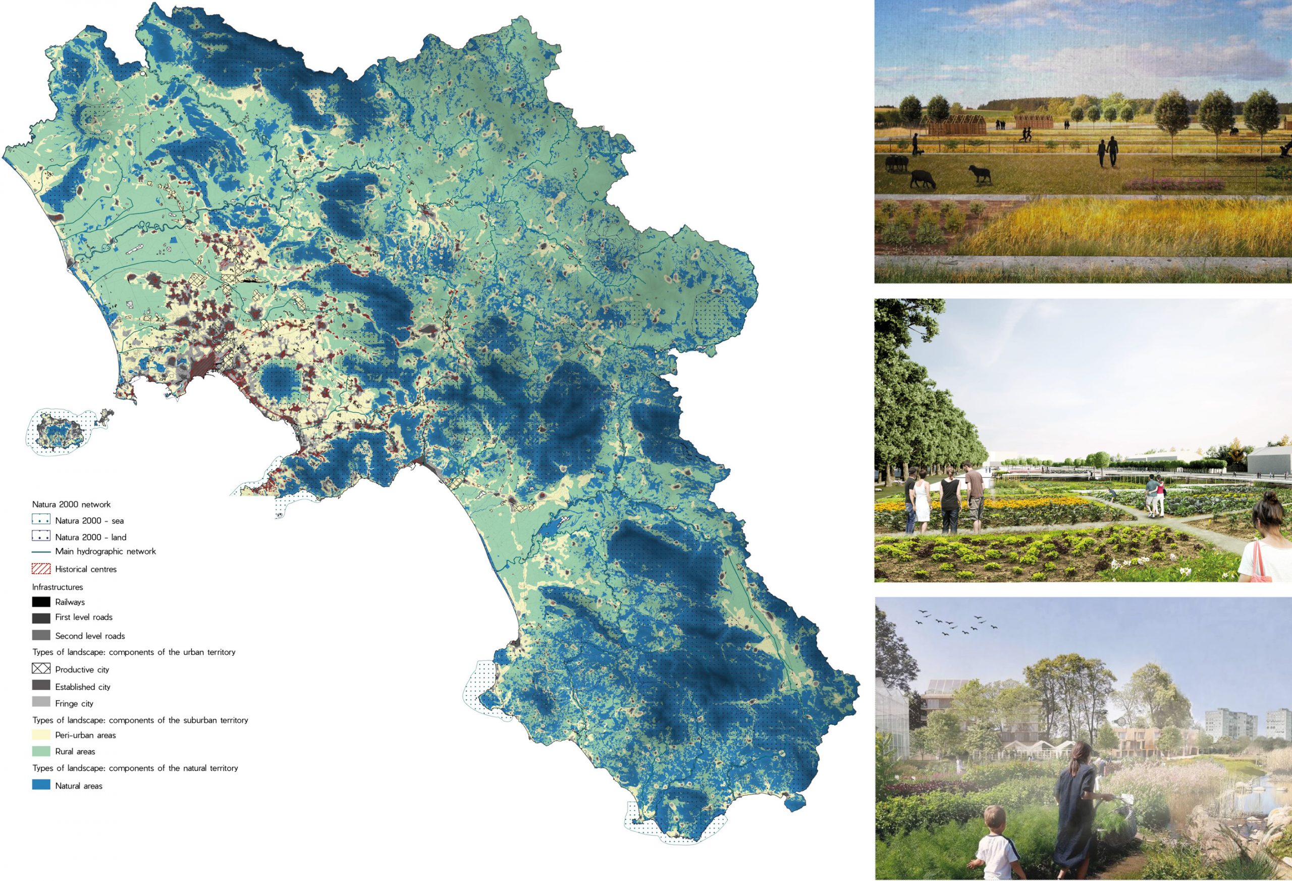
- DiARC – Regione Campania Types of landscape – Overlay framework, 2020 – MAP: Edited by Diarc Team for Landscape Plan for Campania Region PICTURES: n.1 from top. photomontage edited byAnnunziata Alfonso Maria. Urbanism studio_D (DiARC) n.2 from top. photomontage edited by Valentina Vittiglio and Lorena Santamaria. Master Degree in Architecture (DiARC) n. 3 from top. photomontage edited by Salvatore Ferraioli. Urbanism studio_D (DiARC)
-
- DiARC – Regione Campania Wastescape: palces and factors of waste, 2020 – MAP: Edited by Diarc Team for Landscape Plan for Campania Region PICTURES: n.1 and 2 from left. photomontage edited by Alessia Franzese. Master Degree in architecture (DiARC) n. 3 from left. photomontage edited by Fabio Di Iorio and Marco Norcaro.Master Degree in Urban Planning (DiARC)

-

- DiARC – Regione Campania General Framework, 2020
-
- DiARC – Regione Campania Irpinia/ Conza Valley, 2020

-
- DiARC – Regione Campania Metropolitan area/ Napoli-Caserta axis, 2020

-
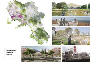
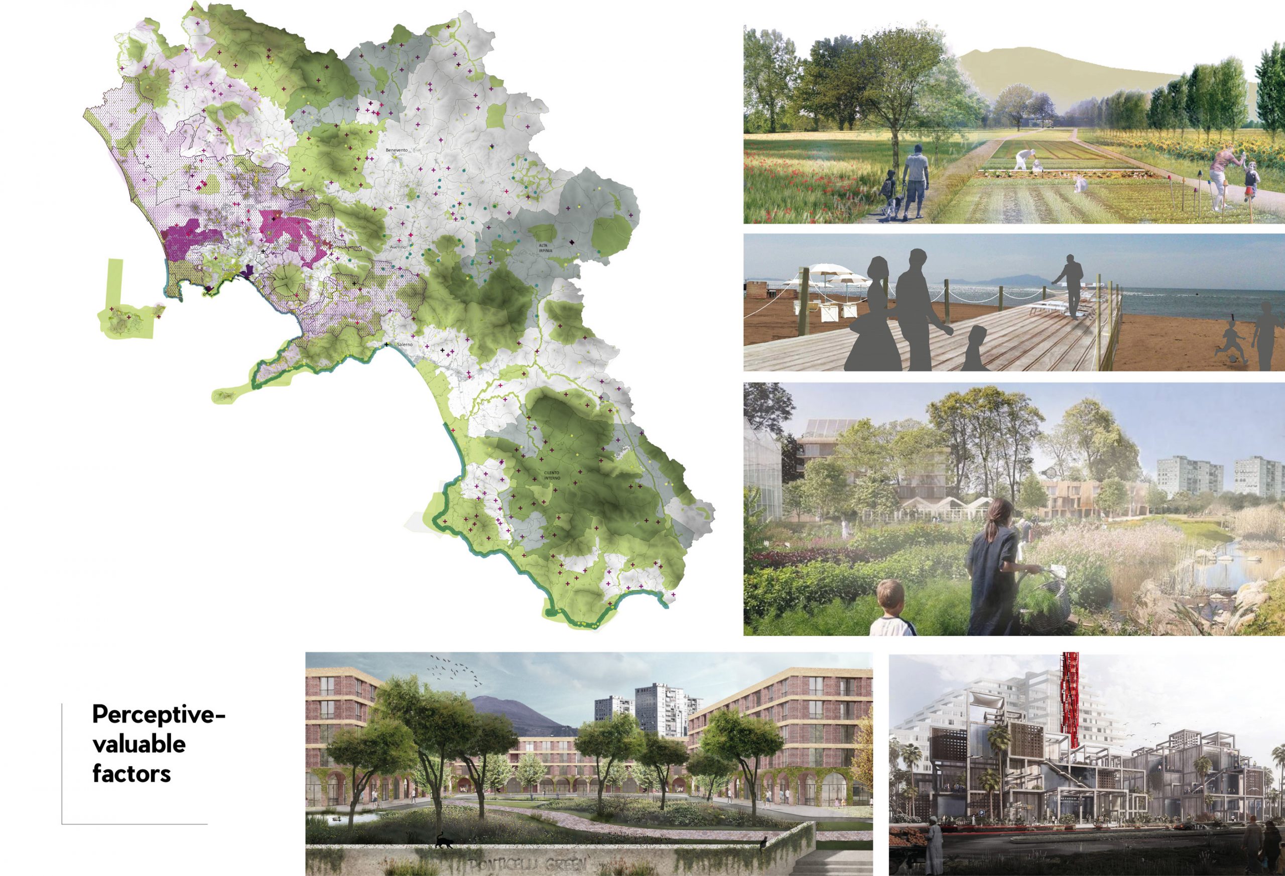
- DiARC – Regione Campania C7.2 EXTRAORDINARY, FRAGILE AND STIGMA LANDSCAPES PERCEPTIVE and VALUABLE factors, 2020 – PICTURES: n.1 from top. photomontage edited by Roberta Braca. Master Degree in architecture (DiARC) n. 2 from top. photomontage edited by Mara Longobardi e Claudia Pengue.Master Degree in Urban Planning (DiARC) n. 3 from top. photomontage edited by Salvatore Ferraioli. Urbanism studio_D (DiARC) n. 1 from bottom-left. photomontage edited by Elisabetta Terracciano. Urbanism studio_D (DiARC) n. 2 from bottom-left. photomontage edited by Marano Francesca. Urbanism studio_D (DiARC)
-
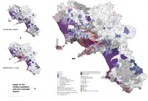
- DiARC – Regione Campania Vulnerability social factors for landscape. potential of migrants and socio-economic-spatial vulnerability factors, 2020

Towards the Regional Landscape Plan 4.0
-

- Towards the Regional landscape plan 4.0 – Regione Campania – Ministero per i beni e le attività culturali e per il turismo – PPR.
-
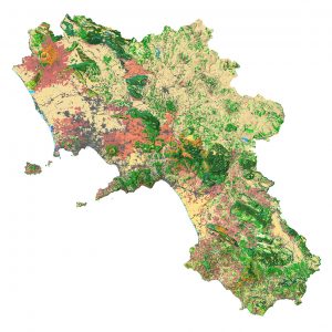
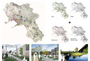
- Regione Campania – Assessorato al governo del territorio Campania Region – The cartographic description of the environmental naturalistic system, combining physical, biotic and anthropogenic factors, gives an overview of the regional territory in which the basic knowledge and elements of natural value emerge but also the territories in which the degradation and fragility of ecosystems are highlighted.

-

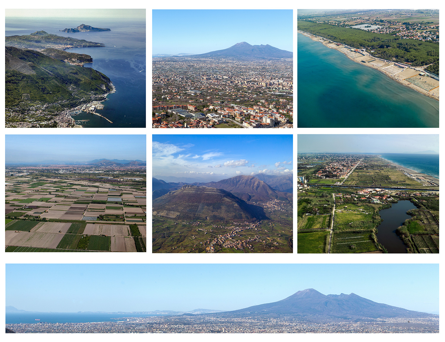
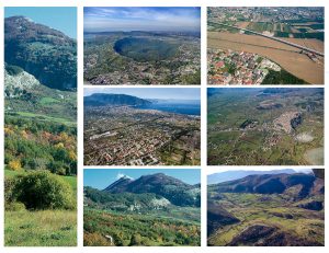
- Regione Campania – Assessorato al governo del territorio Photo 1
-
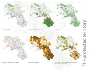
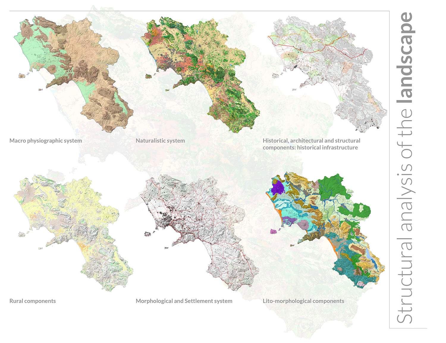
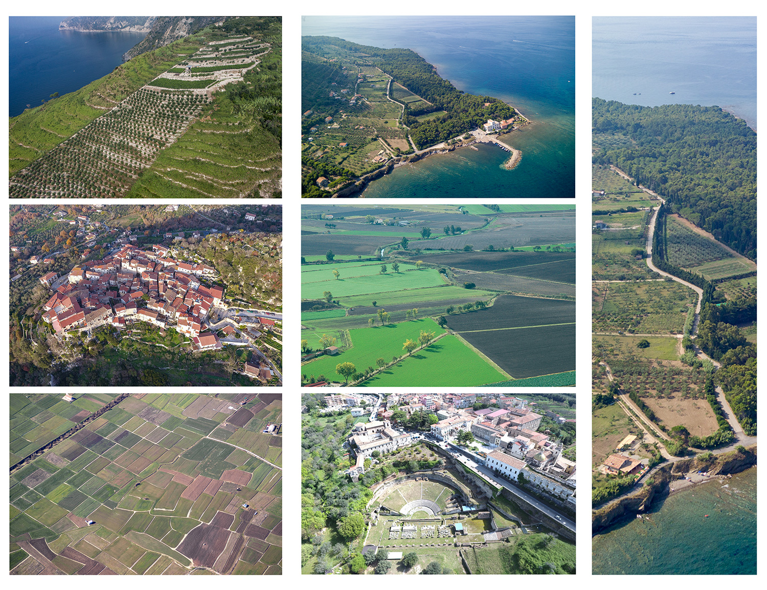
- Regione Campania – Assessorato al governo del territorio Protected territory – In this cartography we highlight the construction of the “recognized landscape”, located at the base of the Plan, corresponding to the geographical landscape, understood as the one sedimented in history in characteristic forms, which confer a particular identity to a region of physical space; it can be defined as the set of natural, physical, rural, anthropogenic and historical-cultural forms.

-
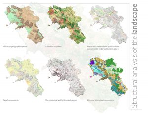
- Regione Campania – Assessorato al governo del territorio Structural analysis – In this cartography we highlight the construction of the “recognized landscape”, located at the base of the Plan, corresponding to the geographical landscape, understood as the one sedimented in history in characteristic forms, which confer a particular identity to a region of physical space; it can be defined as the set of natural, physical, rural, anthropogenic and historical-cultural forms.
-
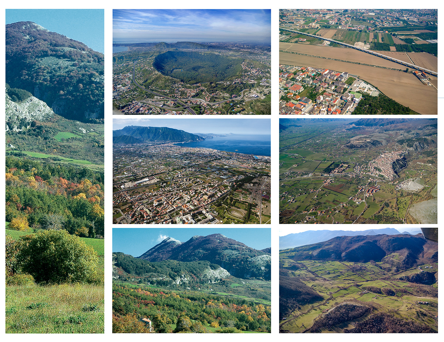
- Regione Campania – Assessorato al governo del territorio Photo 3
-

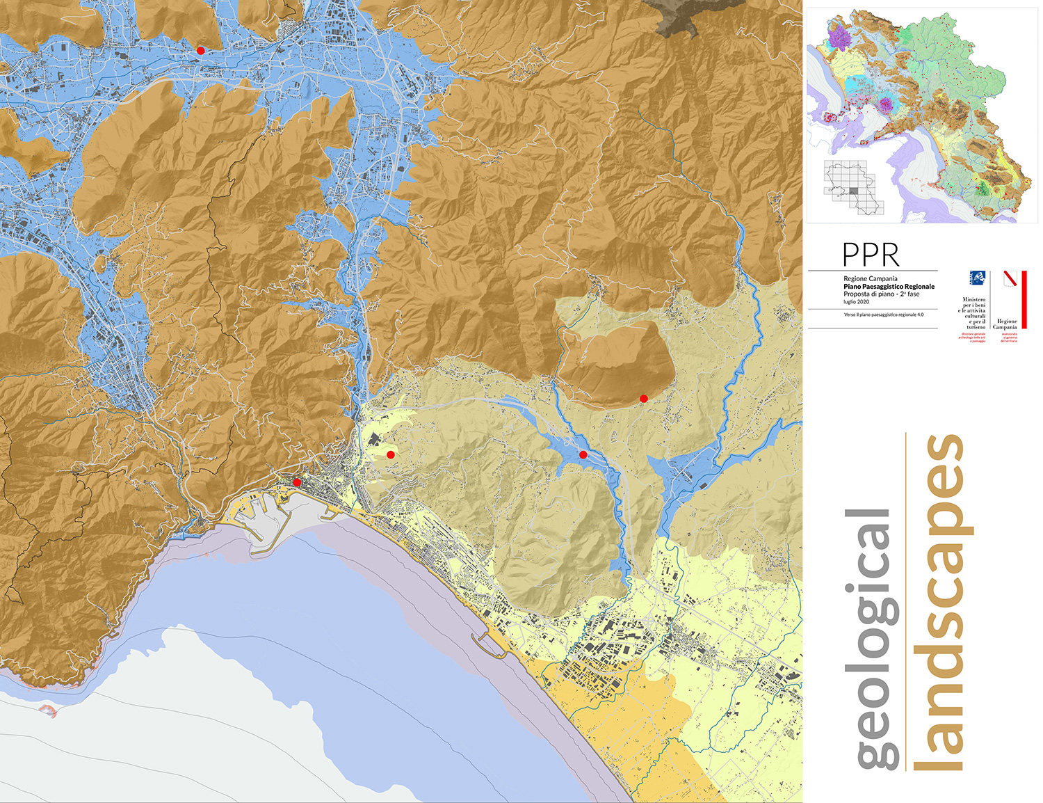
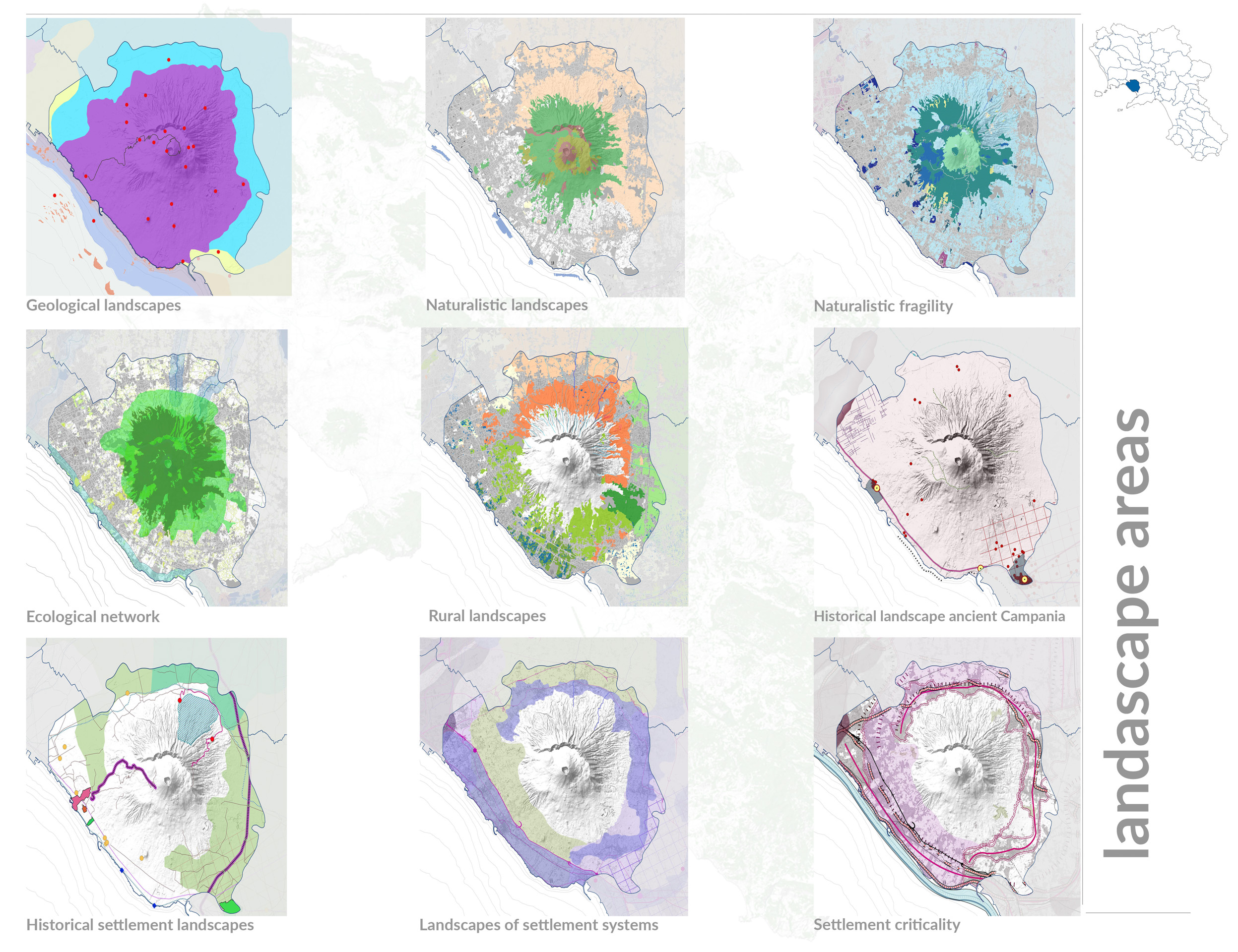
- Regione Campania – Assessorato al governo del territorio Geological landscapes – The Map of the geo-identity Landscape constitutes a collection of the geological singularities of the landscape that have been identified for the intrinsic qualities and particularities, corresponding to the significant traits that also summarize the process of genetic formation.
-

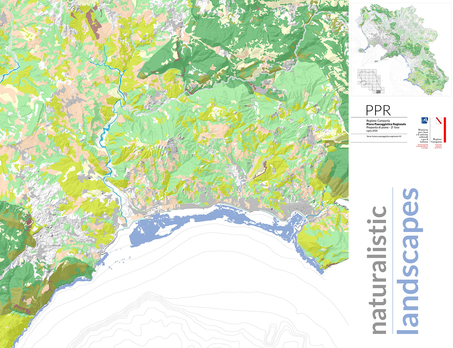
- Regione Campania – Assessorato al governo del territorio Naturalistic landscapes – The Landscape Plan uses as information base the cartography of natural systems that describes natural habitats as “terrestrial or aquatic areas distinguished by their geographical, abiotic and biotic characteristics, which are entirely natural or semi-natural”.
-
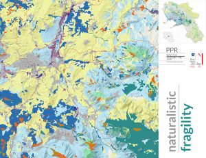
- Regione Campania – Assessorato al governo del territorio Naturalistic fragility – The Charter of Naturalistic Fragility expresses the resilience of natural systems against the stresses and pressures of the surrounding anthropic systems. It comes from the combination of Anthropogenic Pressure and Ecological Sensitivity, according to a matrix that relates the classes in which they are articulated respectively.

-
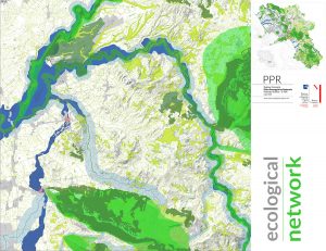
- Regione Campania – Assessorato al governo del territorio Ecological network – The ecological network is one of the key tools for implementing biodiversity policies and strategies and more generally for the conservation of the natural landscape. It considers: the structure of the Natura 2000 network, the environmental units of the highest natural value present on the regional territory; the main ecological connecting lines based on current or potential elements of naturalness.

-

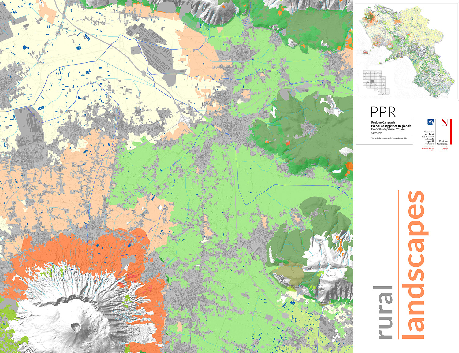
- Regione Campania – Assessorato al governo del territorio Rural landscapes – The map called “Rural Landscapes” shows the main typological units of the “agricultural mosaics”, found at a regional scale, limited to the “cultivated” areas, that is to the habitats classified agricultural by the “Charter of Nature”, implemented by the detection of greenhouse plants derived from the CTR.
-

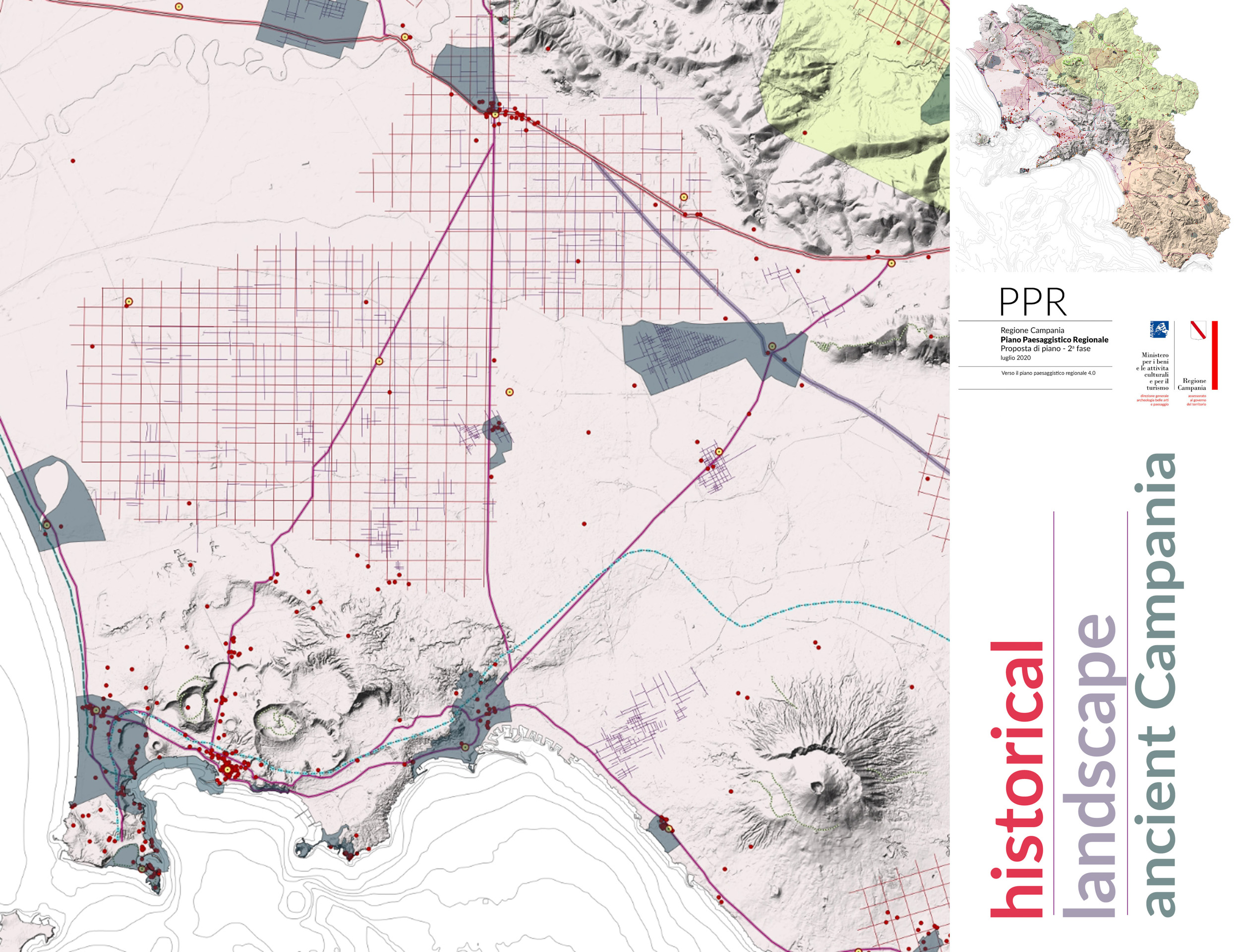
- Regione Campania – Assessorato al governo del territorio Historical landscapes antica Campania – The mapped components, stratified in a historical moment marked by profound changes in the political, social and urban structure of the territory (between the fourth century B.C. and the fifth century B.C. ), contemplate the ancient natural landscapes, the predominant settlements, the most important archaeological evidence, the ancient road infrastructure (roads, bridges, waterways and aqueducts), the ancient agricultural network and the contexts of great historical and cultural value.
-
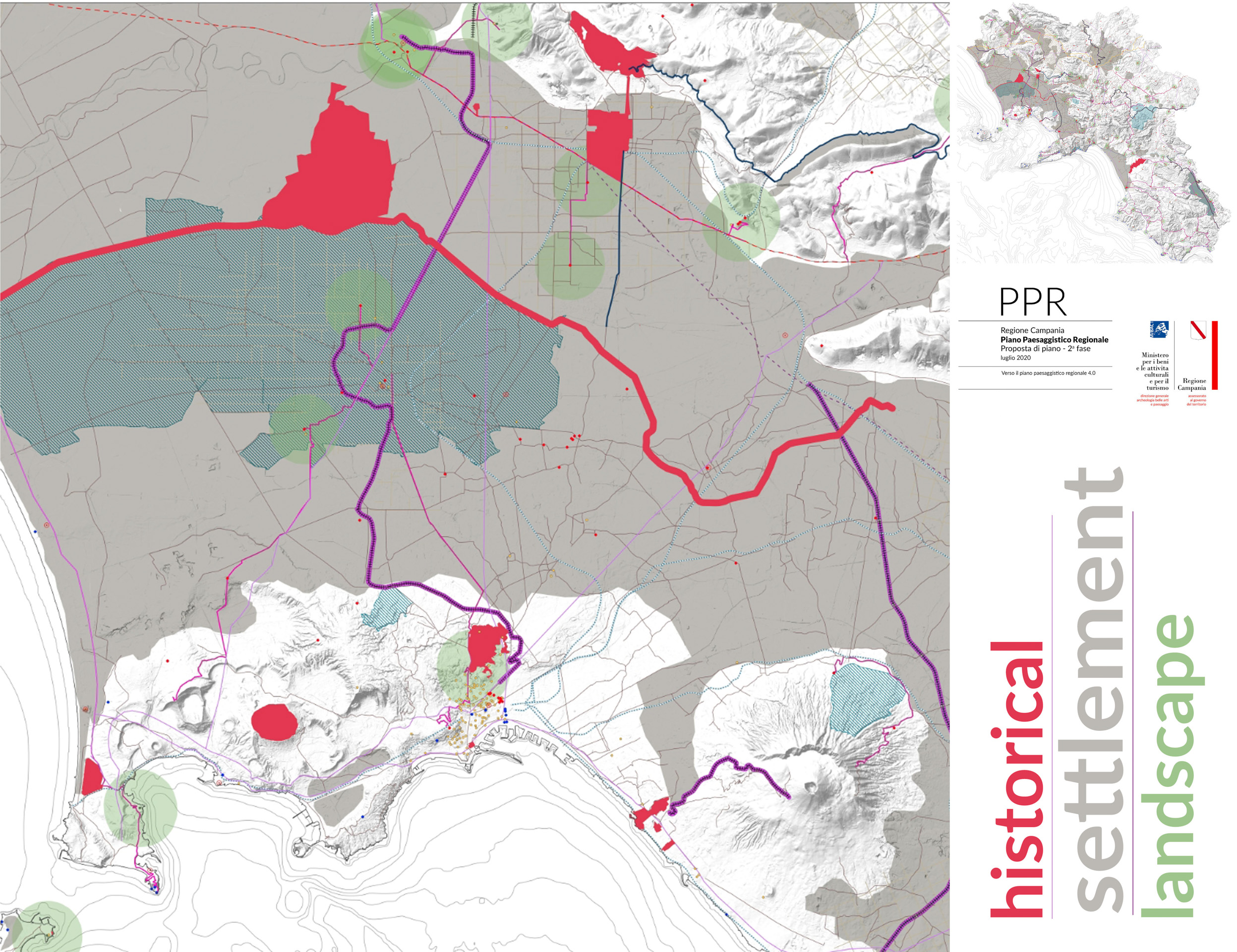
- Regione Campania – Assessorato al governo del territorio Historical settlement landscape – They describe the historical settlement processes whose evolution is framed between the decline of the Roman Empire and the Bourbon period (XVIII-XIX century). We find, in the contents of this cartography, the path of the historical evolution of the territory that starts from the narrow communities around the first Christian churches and basilicas, and arrives to the Bourbon period of architectural renewal, infrastructural works and the important work of reclamation and water supply.
-
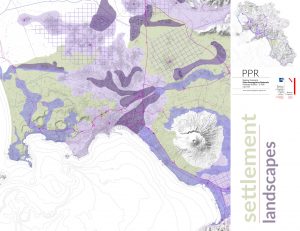
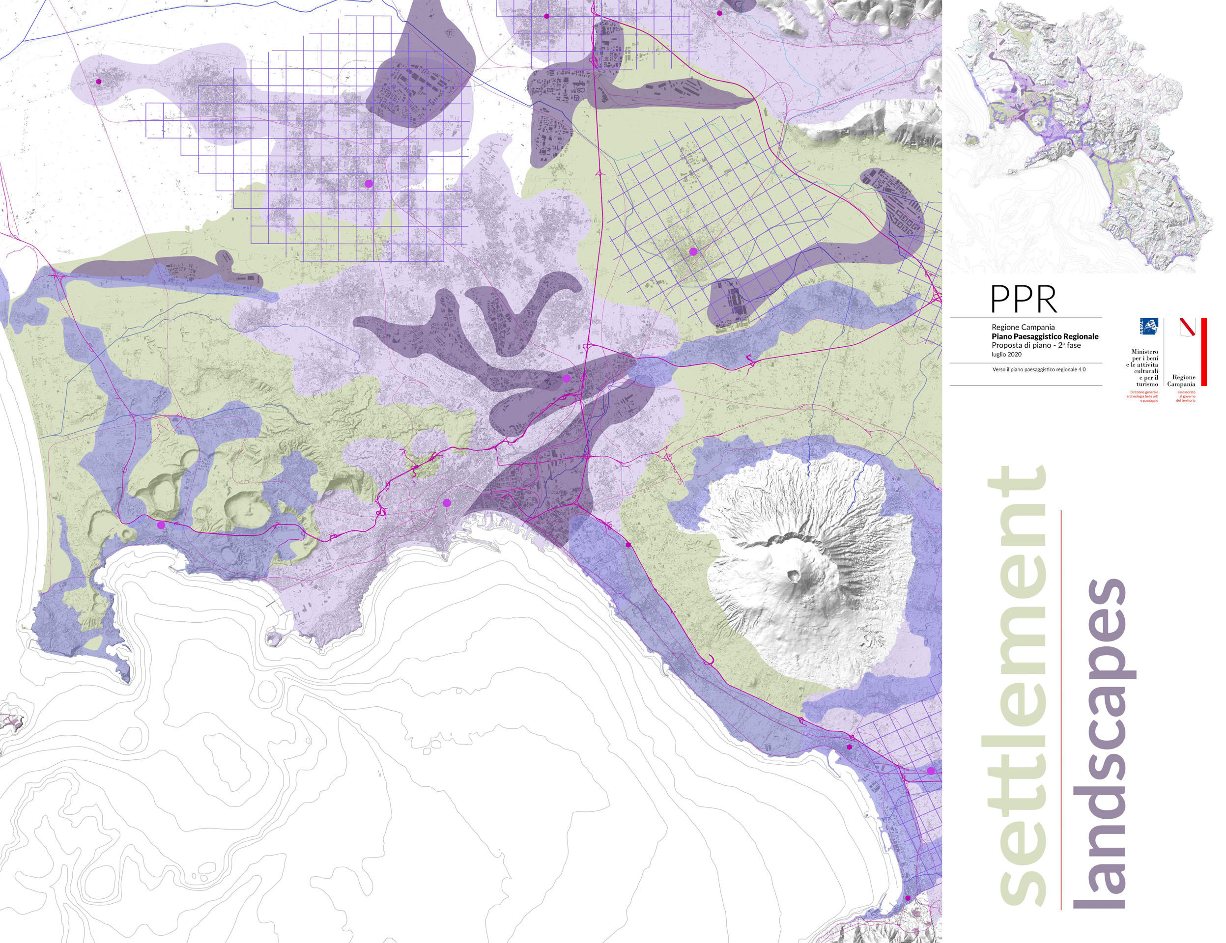
- Regione Campania – Assessorato al governo del territorio Settlement landscapes – The interpretative analysis of the settlement system has led to the identification of a cognitive framework attributable to a series of structural matrices and to some morphological elements, which have made it possible to articulate the areas in “landscapes”. The identified structural matrices are those of the landscapes of the urban nebulae, of the continuous urbanized belts, the productive plates, the settlement dispersion and the historical centers of the inner areas.
-
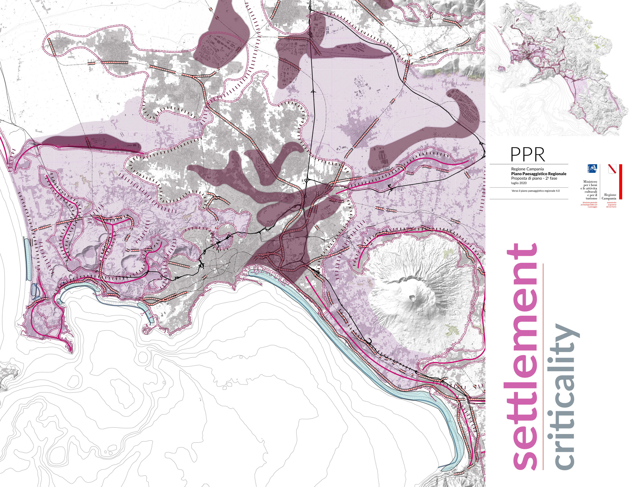
- Regione Campania – Assessorato al governo del territorio Settlement criticality – This cartography represents the interpretative analysis of the settlement system. It led to the identification of a series of structural matrices and some morphological elements, attributable to specific distinctive landscapes of the territory of Campania and highlighted some critical issues attributable to the perception of elements that hinder the organisation and differentiation of the built-up area.
-
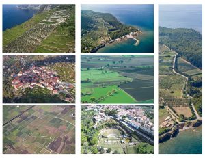
- Regione Campania – Assessorato al governo del territorio Photo 3
-
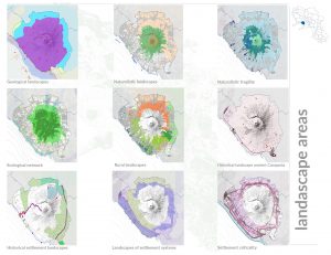
- Regione Campania – Assessorato al governo del territorio Landscape areas – The methodological approach adopted by the Landscape Plan, for the structural reading of the landscape, has provided for the articulation of the regional territory in five systems: physical, naturalistic, rural, historical-cultural and settlement. The landscape has been articulated in the five systems and then proceed to their recomposition through summaries that, starting from the structural reading, provide guidelines oriented to safeguard and enhancement. Thanks to the reading and interpretation of the landscape we then moved to the analysis of detail of the individual areas to reach the identification of the values that characterize the different territories and that have guided the development of landscape quality objectives, guidelines and guidelines for planning.
-
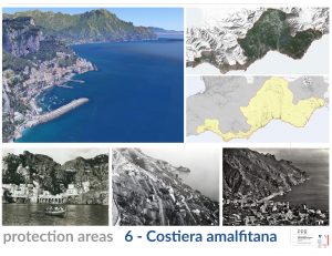
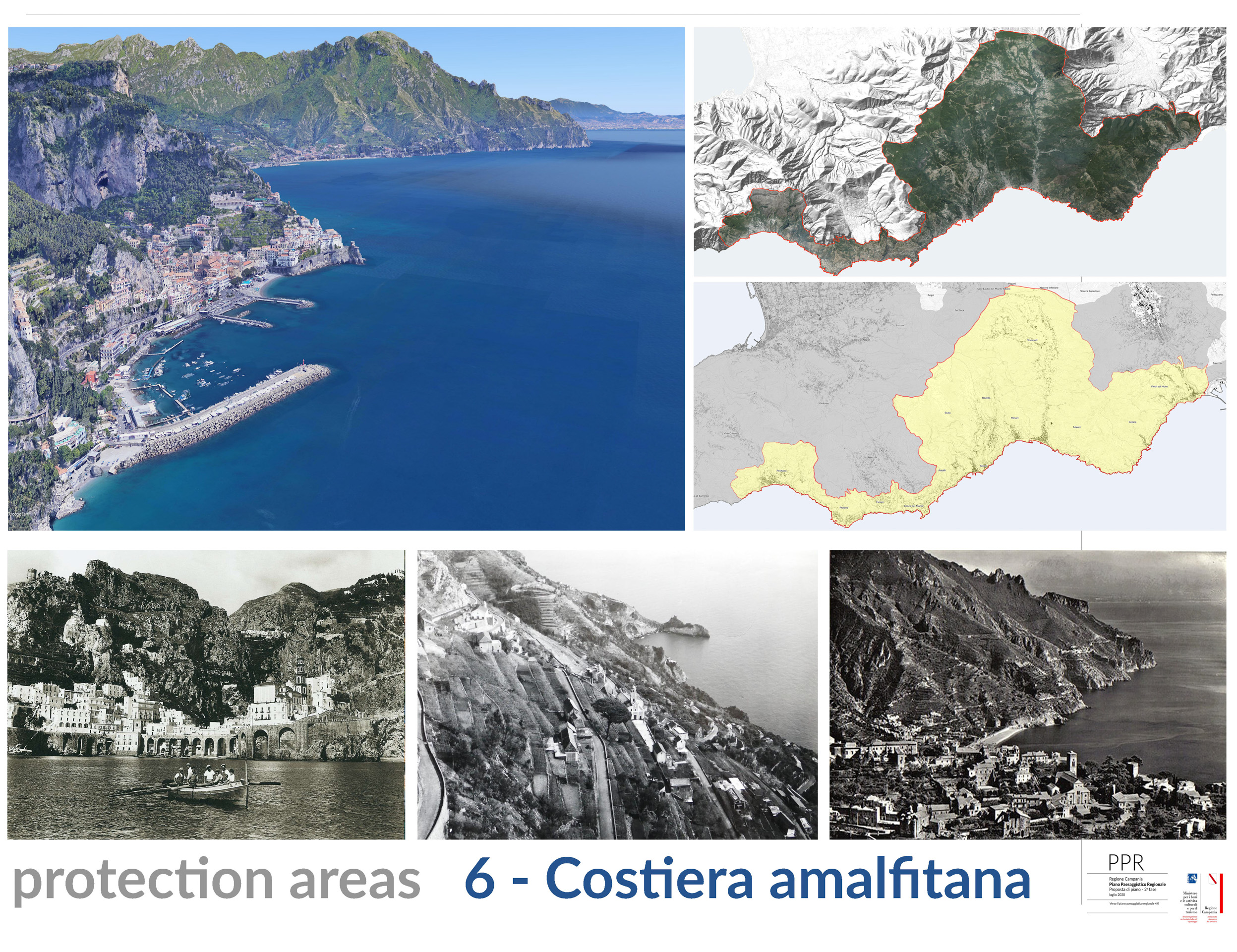
- Regione Campania – Assessorato al governo del territorio Protection areas – The areas of the declarations of considerable public interest have been grouped according to areas of territorial homogeneity and landscape characteristics. Each area is described with reference to the identifying elements of each declaration of great public interest, the Ministerial Decrees, the identification of the values, the evaluation of permanence and/or transformations, providing a concise reading of the elements characterizing each area.
-
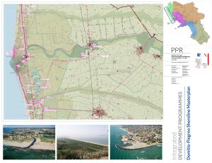
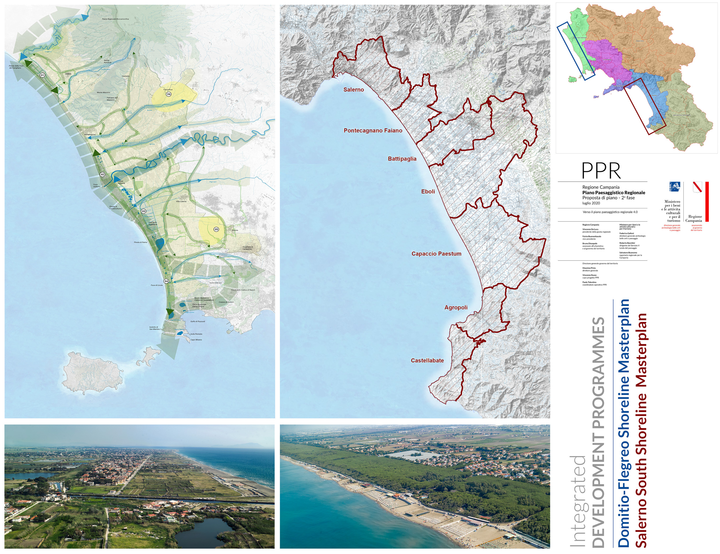
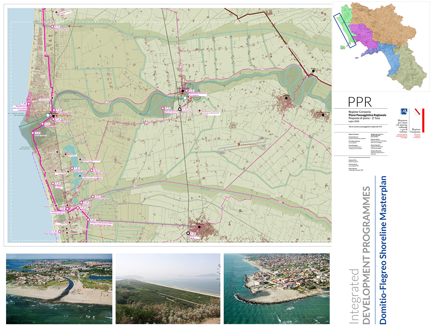
- Regione Campania – Assessorato al governo del territorio Development area Domitio-Flegreo – The Landscape Plan provides as development drivers the enhancement of the territory and in particular the actions that provide for the redevelopment and rehabilitation of the territorial context. The Integrated Exploitation Programme represents the operational and implementation phase of the PPR guidelines and in particular, recognizing values, criticality and potential of the complex system of landscape environments, it draws into a large territorial project, its transformation and sustainable development providing an articulated set of measures, actions and projects.
-

- Regione Campania – Assessorato al governo del territorio Development area Salerno gulf – The Landscape Plan provides as development drivers the enhancement of the territory and in particular the actions that provide for the redevelopment and rehabilitation of the territorial context. The Integrated Exploitation Programme represents the operational and implementation phase of the PPR guidelines and in particular, recognizing values, criticality and potential of the complex system of landscape environments, it draws into a large territorial project, its transformation and sustainable development providing an articulated set of measures, actions and projects.