Andreas Kipar
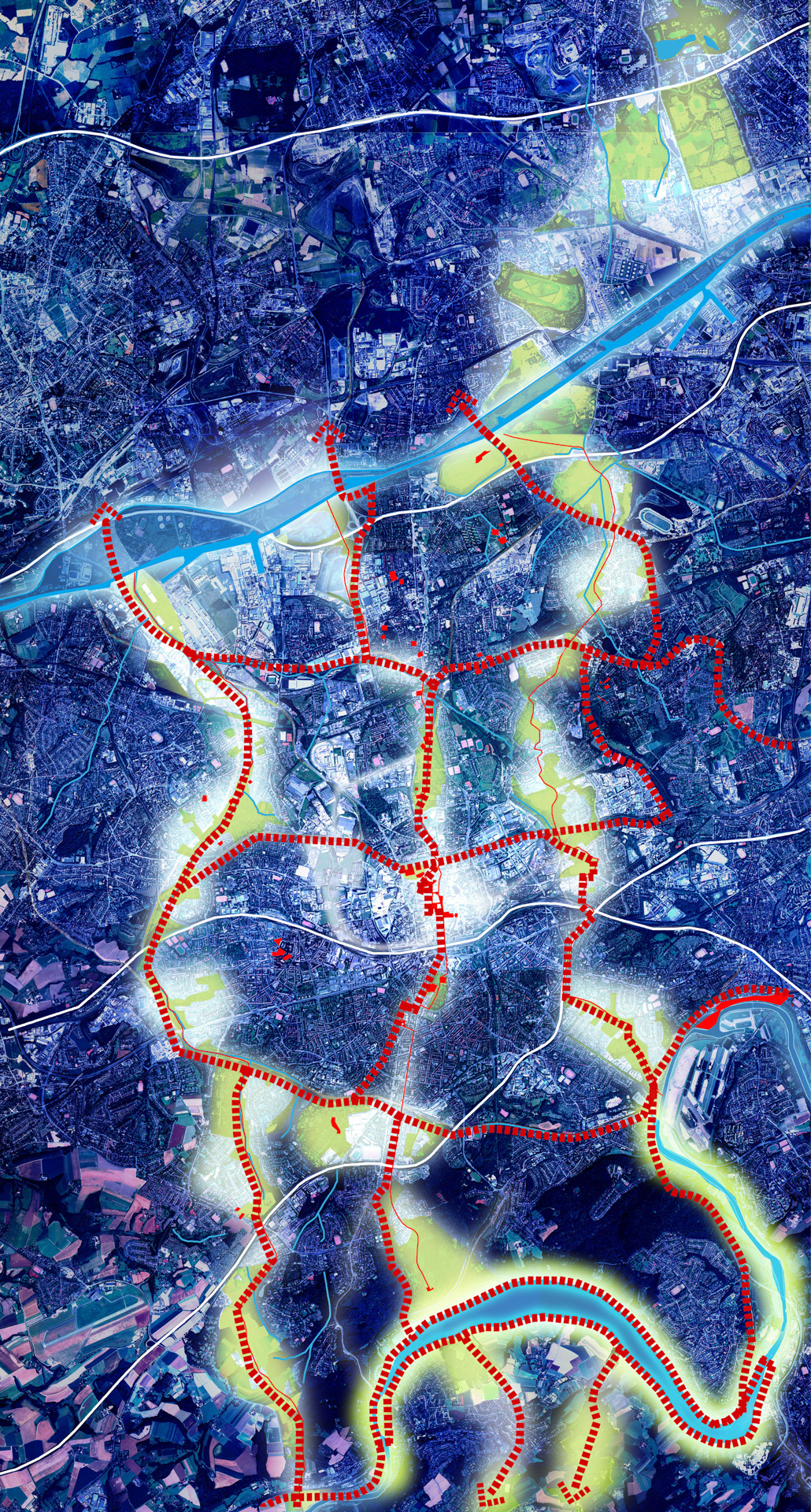
Architect, landscapist and urban planner, Andreas Kipar is the founder and Creative Director of the international landscape architecture studio LAND, with offices in Germany, Italy and Switzerland. A graduate in Landscape Architecture at the GHS University of Essen and in Architecture and Urban Planning at Milan Politecnico, where he has taught Public Space Design since 2009, he often holds seminars and lectures at a number of universities, including Naples, Dresden, Venice, Zurich, Versailles and Dortmund. He is a full member of the German Academy of Urban and Regional Planning (DASL), the Association of German Landscape Architects (BDLA), the Italian Association of Landscape Architects (AIAPP) and the Italian Urban Planning Institute (INU). He is the inventor of the “Raggi Verdi” [Green Rays] model in Milan, which connect up the various areas of the city to favour a new slow mobility from the centre towards the suburbs. This model, internationally recognised as a pioneering one in green urban planning, has also had subsequent applications in Essen, the European Green Capital 2017, and in the award-winning Smart City of Rublyovo-Arkhangelskoye in Moscow.
-
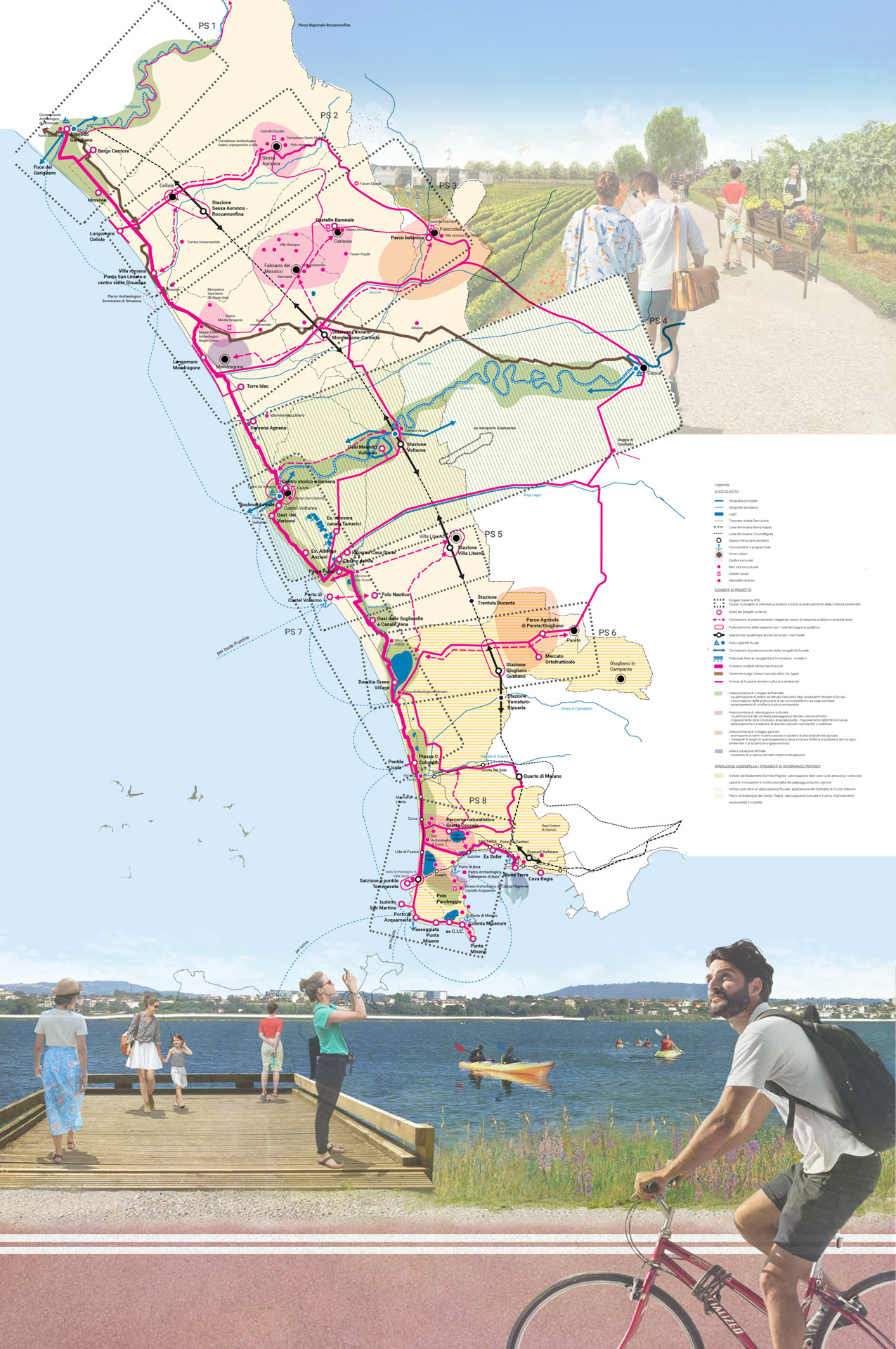
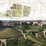
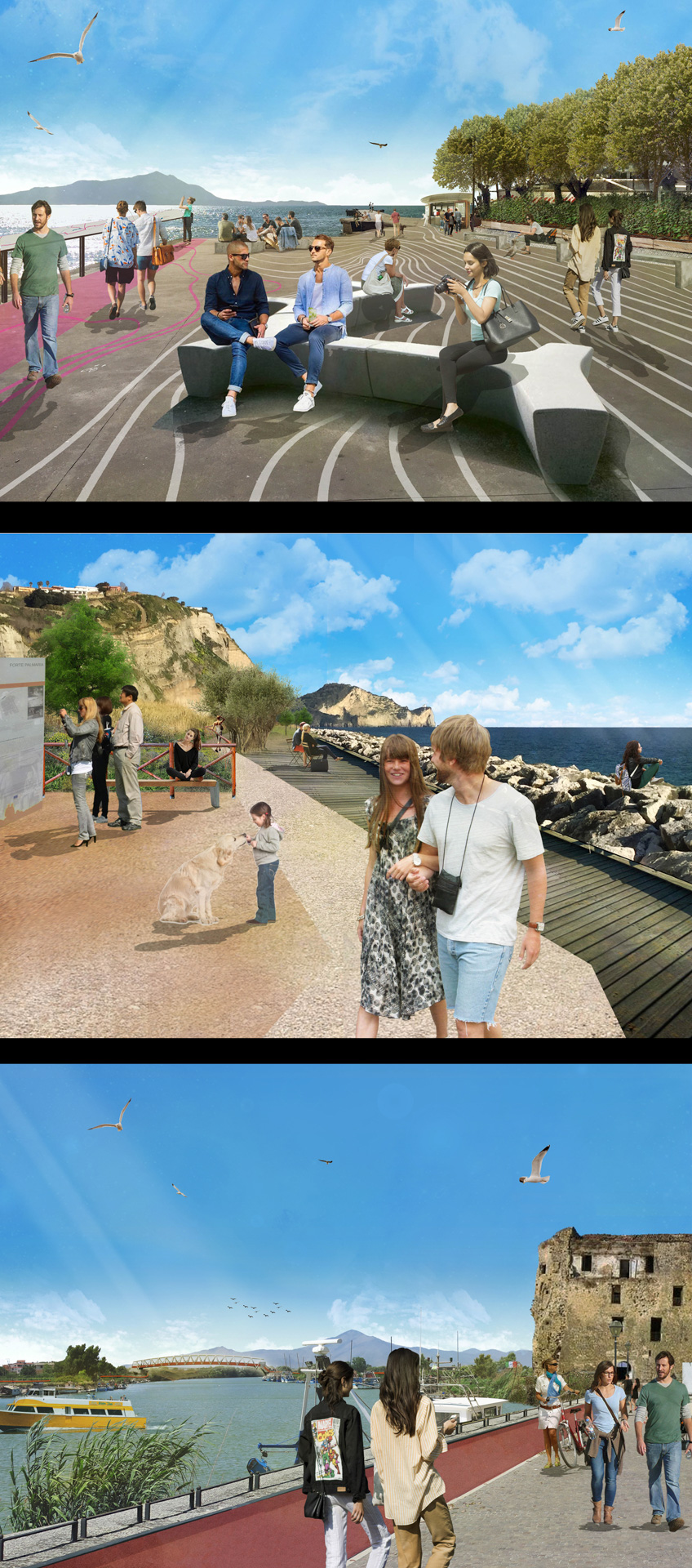
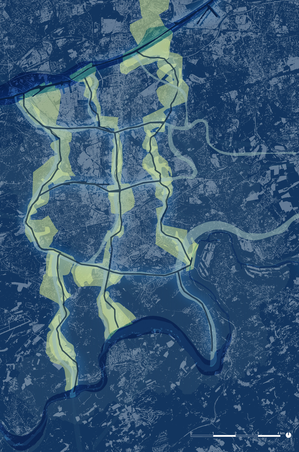
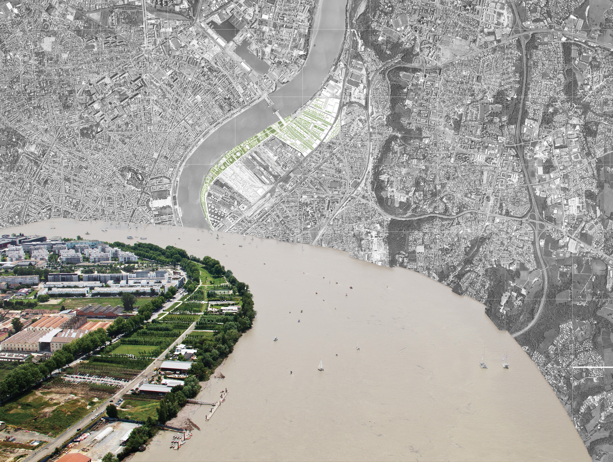
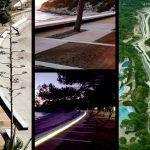
- LAND MASTERPLAN LITORALE DOMIZIO-FLEGREO – Campania, Italy, 2019 Credits: LAND
-
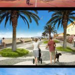
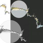
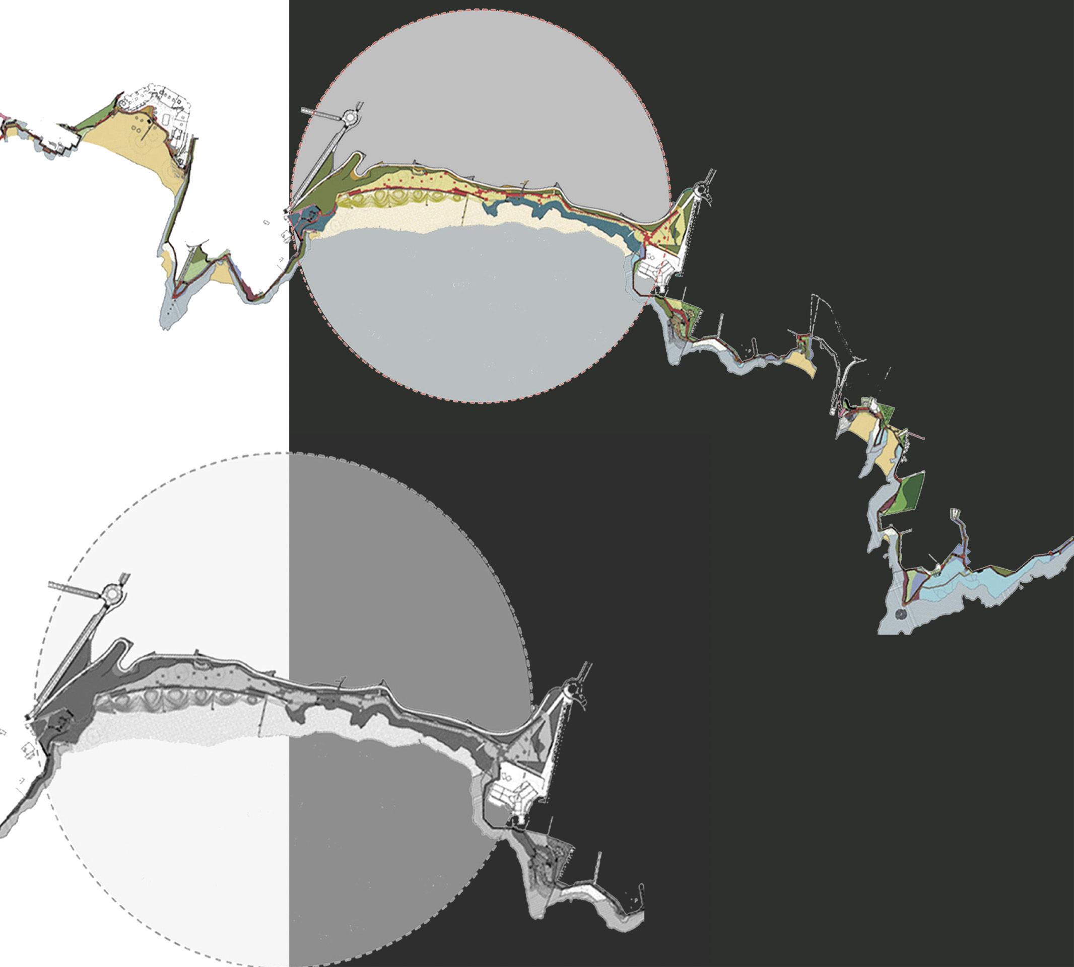
- LAND MASTERPLAN LITORALE DOMIZIO-FLEGREO – Campania, Italy, 2019 Photomontages and rendering. From top to bottom:Licola, Mondragone Torre idac. Credits: LAND
-
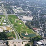
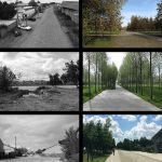
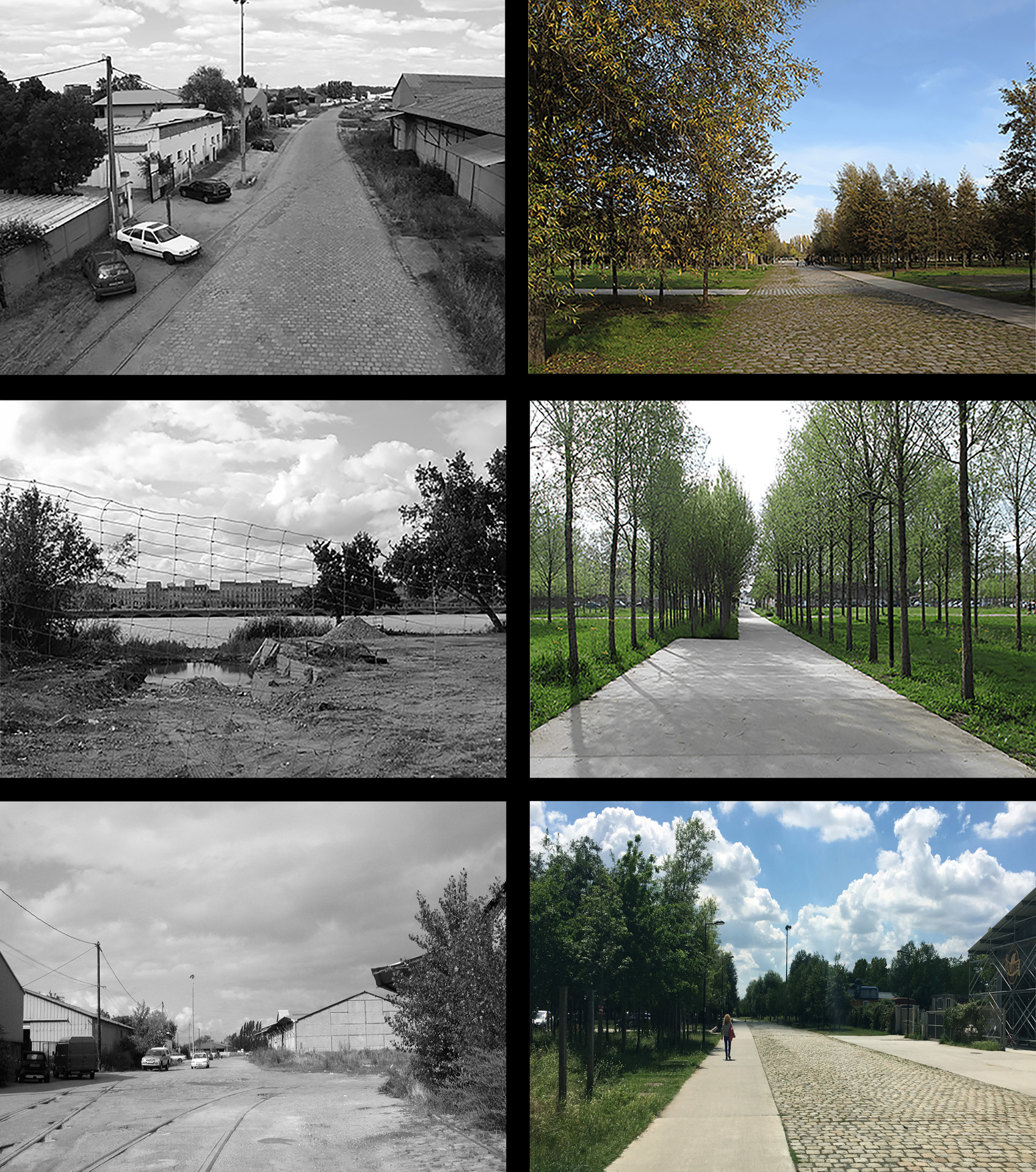
- LAND Germany ESSEN 2017. European Green Capital – Essen, Germany Photo of the project. Credits LAND
-
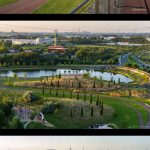
- LAND Germany ESSEN 2017. European Green Capital – Essen, Germany Photos of the project. Credits LAND
-
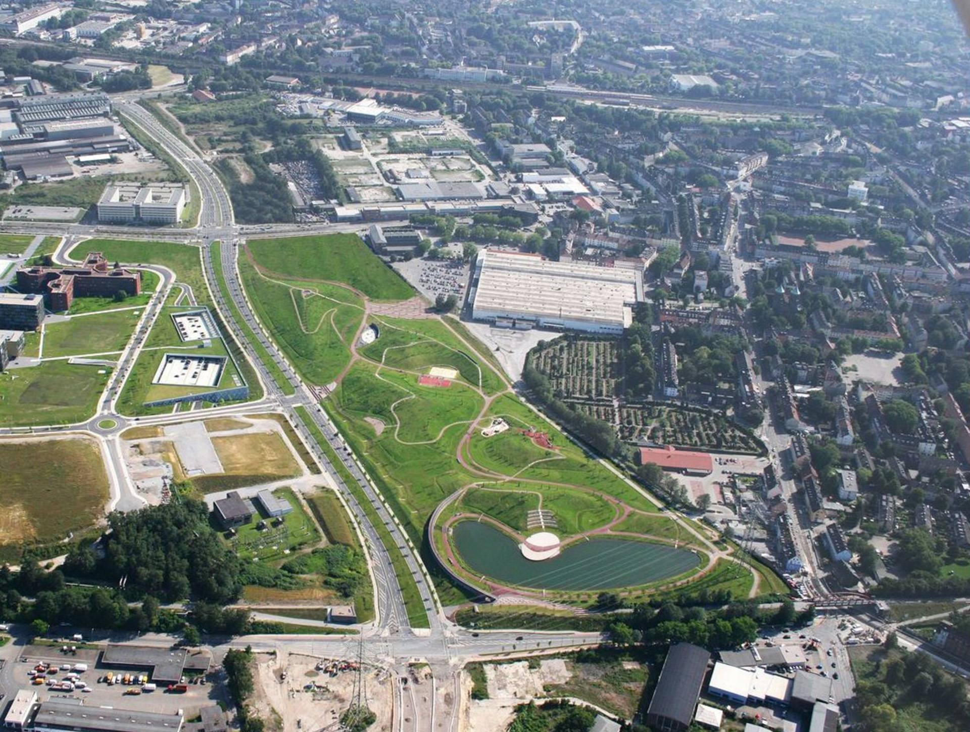
- LAND Germany ESSEN 2017. European Green Capital – Essen, Germany Masterplan Credits LAND
-
- LAND Italy PORTELLO PARK – Milano, Italy, 1997 – in corso Masterplan and photo of project by Nicola Colella. Credits LAND Italy, Andreas Kipar, Charles Jencks

-
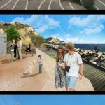
- LAND MASTERPLAN LITORALE DOMIZIO-FLEGREO – Campania, Italy, 2019 Photomontages and rendering. From top to bottom: Torregaveta, Monte di Procida, Castel Volturno. Credits: LAND
-
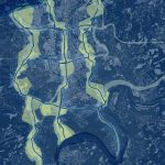
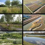
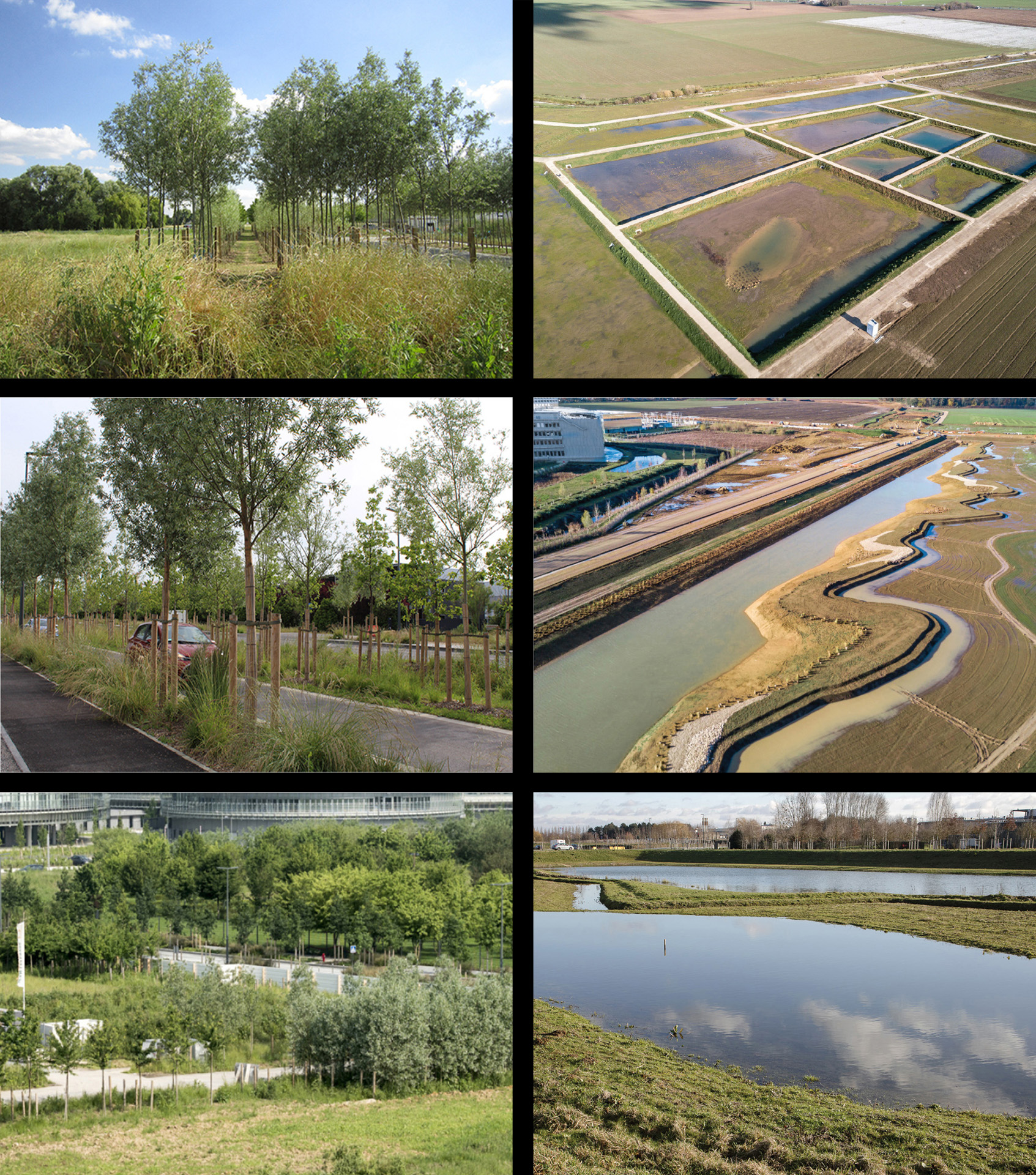
- LAND WATER BASED CITIES, 2019 Milano Sponge City. Credits: LAND

-
- LAND WATER BASED CITIES, 2019 Essen Back to Nature. Credits: LAND
-
- LAND WATER BASED CITIES, 2019 Genova Intangible water. Credits: LAND
Michel Desvigne
is a landscape architect internationally renowned for his rigorous and contemporary designs and for the originality and relevance of his research work. He has developed projects in more than twenty-five countries, where his work helps in highlighting the landscapes and rendering them visible, in understanding the mechanisms at work giving them form, and in acting upon these mechanisms in order to transform the landscapes and imbue them with meaning. In 2011, he received France’s Grand Prize for Urbanism for his continual contribution to and reflection upon the city and larger territory. In 2014, he was awarded the European Prize for Urban Public Space for his restoration project of the Old-Port of Marseille.
-
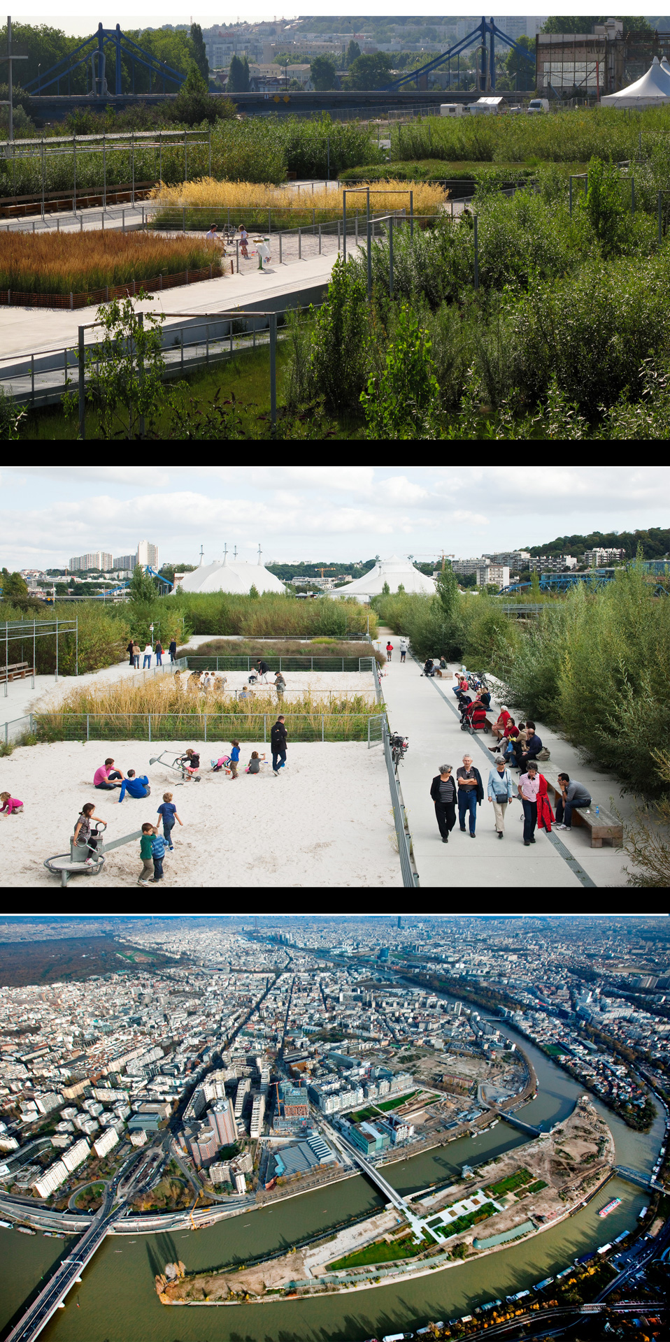
- MIchel Desvigne – ILE SEGUIN_ JARDIN DE PREFIGURATION – Boulogne-B Masterplan.The Île Seguin-Rives de Seine urban plan, a new stretch of multifunctional city, is coming to life on the former land of the Renault factory. The Seguin Island Gardens occupy the site of the future park and serve as a seed for future planning. Credits Project team: MDP Michel Desvigne, Paysagiste (lead consultant) IHA Inessa Hansch, Architecte urbaniste AIK, Yann Kersalé, Lumière Rudi Baur, Dessin graphique. Credits: MDP
-
- MIchel Desvigne – ILE SEGUIN_ JARDIN DE PREFIGURATION – Boulogne-B Photos of the project. The artificial island used to be crisscrossed by water pits belonging to the former Renault factory. These pils are now remembered by the sunken gardens. Several learning gardens and a series of information panels allow visitors to know the key issues of the intervention. Playgrounds are located in the middle of the park and are especially protected. Toys imitate construction tool. Credits Project team: MDP Michel Desvigne, Paysagiste (lead consultant) IHA Inessa Hansch, Architecte urbaniste AIK, Yann Kersalé, Lumière Rudi Baur, Dessin graphique. Credits: MDP, (at the bottom) P. Guignard – SAEM Val de Seine Aménagement Boulogne-Billancourt
-

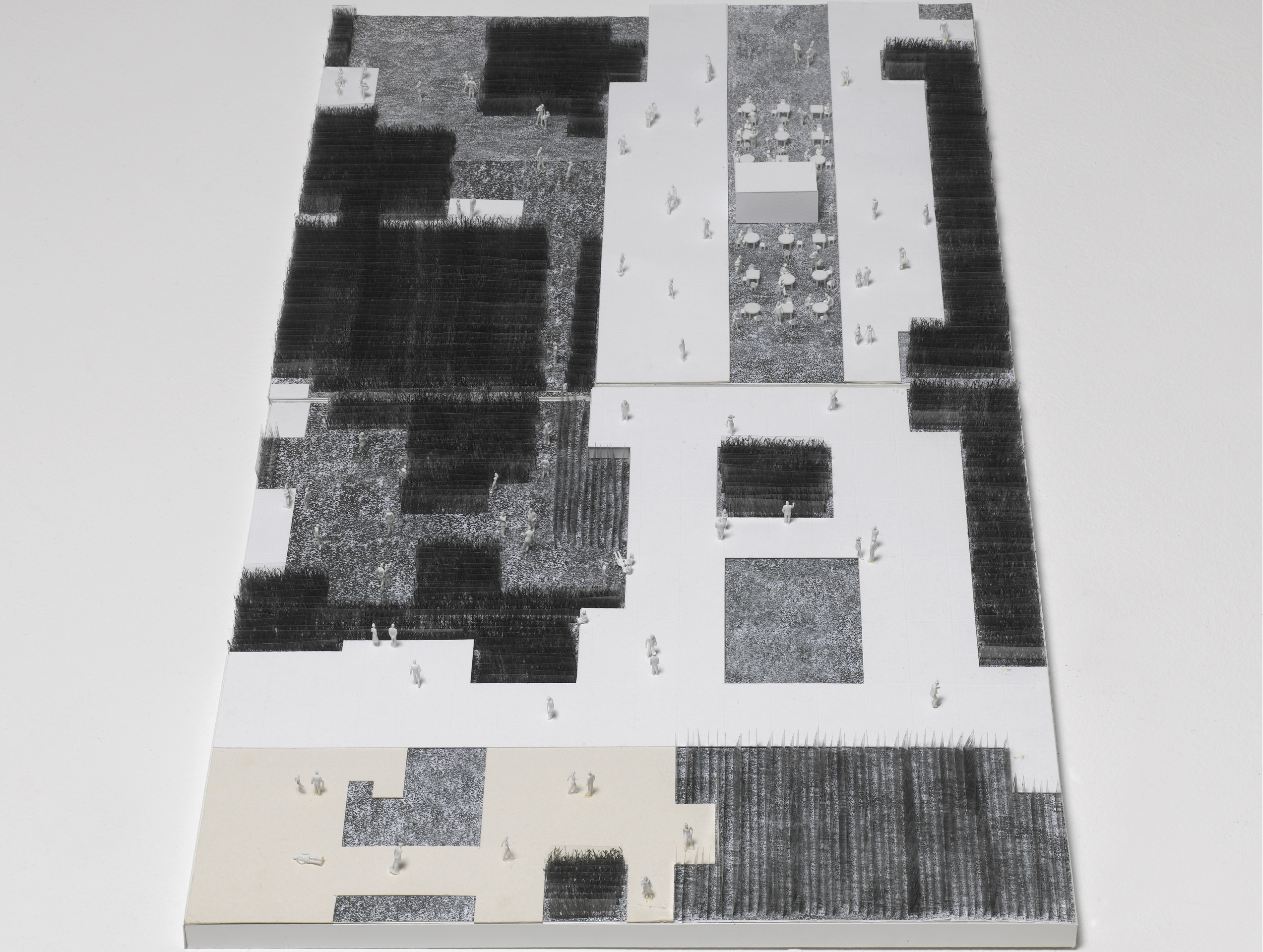
- MIchel Desvigne – ILE SEGUIN_ JARDIN DE PREFIGURATION – Boulogne-B Study model, Grouping the different plantation types creates differentiated areas and eases maintenance. Credits Project team: MDP Michel Desvigne, Paysagiste (lead consultant) IHA Inessa Hansch, Architecte urbaniste AIK, Yann Kersalé, Lumière Rudi Baur, Dessin graphique. Credits: MDP
-
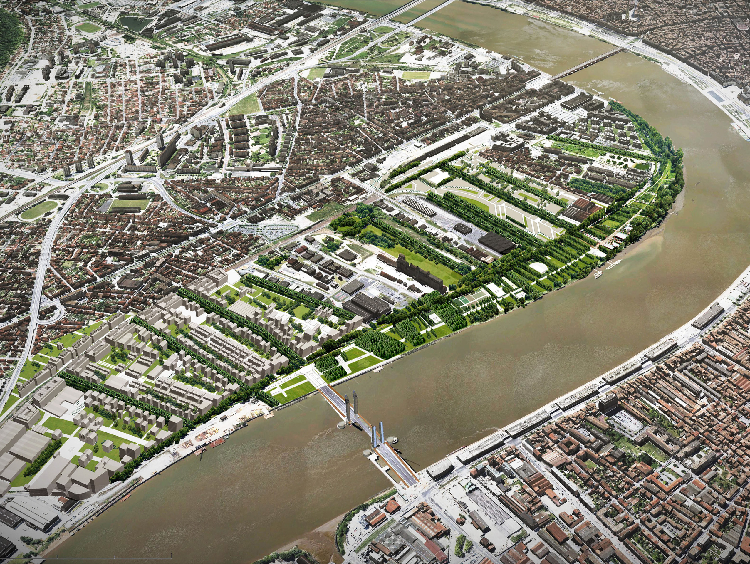
- MIchel Desvigne – LE PARC AUX ANGELIQUES – Bordeaux, France, 2012 Park project on the right bank, facing the dense historical city on the left bank. On the edge of river bank, the industrial strips are replaced by the plantations as they are released.Thus, parc aux Angéliques forms a thick vegetal front on the Garonne, which contrasts with the “”stone city”” opposite Simulation of the right bank parc in aereal wiev facing south. Credits MDP Michel Desvigne Paysagiste (mandataire) IHA Inessa Hansch Architecte Artelia Bordeaux. Credit: MDP
-
- MIchel Desvigne – LE PARC AUX ANGELIQUES – Bordeaux, France, 2012 The fluvial landscape before the redevelopment project : The programmed end of industrial and port activities gradually released a very vast territory, still in disinheritance in 2003. n the part purchased by the City, a park is being installed that is not “pretty”. It is a quasi-forest device, implanted on both sides of a large preserved paved road. Paths perpendicular to the Garonne River, bordered by poplars, open up perspectives on fleuve, on the protected riverbank bordering it, and on the city. Photos before the project ( on the left), photos of the on going project (on the right) Credits MDP Michel Desvigne Paysagiste (mandataire) IHA Inessa Hansch Architecte Artelia Bordeaux. Credit: MDP Credit: From left the Fourth phot (Guillaume Leuregans)
-
- MIchel Desvigne – LE PARC AUX ANGELIQUES – Bordeaux, France, 2012 Photos of the ongoing project and masterplan Plan of synthesis of the evolution of the project for the whole parc aux Angéliques: the drawing inscribes in space the decisions resulting from the public consultation MDP Michel Desvigne Paysagiste (mandataire) IHA Inessa Hansch Architecte Artelia Bordeaux Credits photo: Mairie de Bordeaux, Thomas Sanson. Credit masterplan: MDP
-
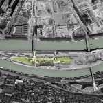
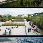
- MIchel Desvigne – PARIS-SACLAY, LISIERE – Plateau de Saclay, Esson Photos of the park. The park is a quasi-forest device, implanted on both sides of a large preserved paved road. Paths perpendicular to the Garonne River, bordered by poplars, open up perspectives on fleuve, on the protected riverbank bordering it, and on the city. Credits Michel Desvigne Paysagiste (Lead Consultant) Xaveer de Geyter, Floris Alkemade, Architectes-Urbanistes Arep Sogreah Setec Alto Tractebel. Credit: MDP. From left: second photo: EPAPS
-
- MIchel Desvigne – PARIS-SACLAY, LISIERE – Plateau de Saclay, Esson The study plan for the south campus shows the integration of the new poles into the “intermediate landscape” of the northern edge. Credits Michel Desvigne Paysagiste (Lead Consultant) Xaveer de Geyter, Floris Alkemade, Architectes-Urbanistes Arep Sogreah Setec Alto Tractebel. Credit: MDP
-
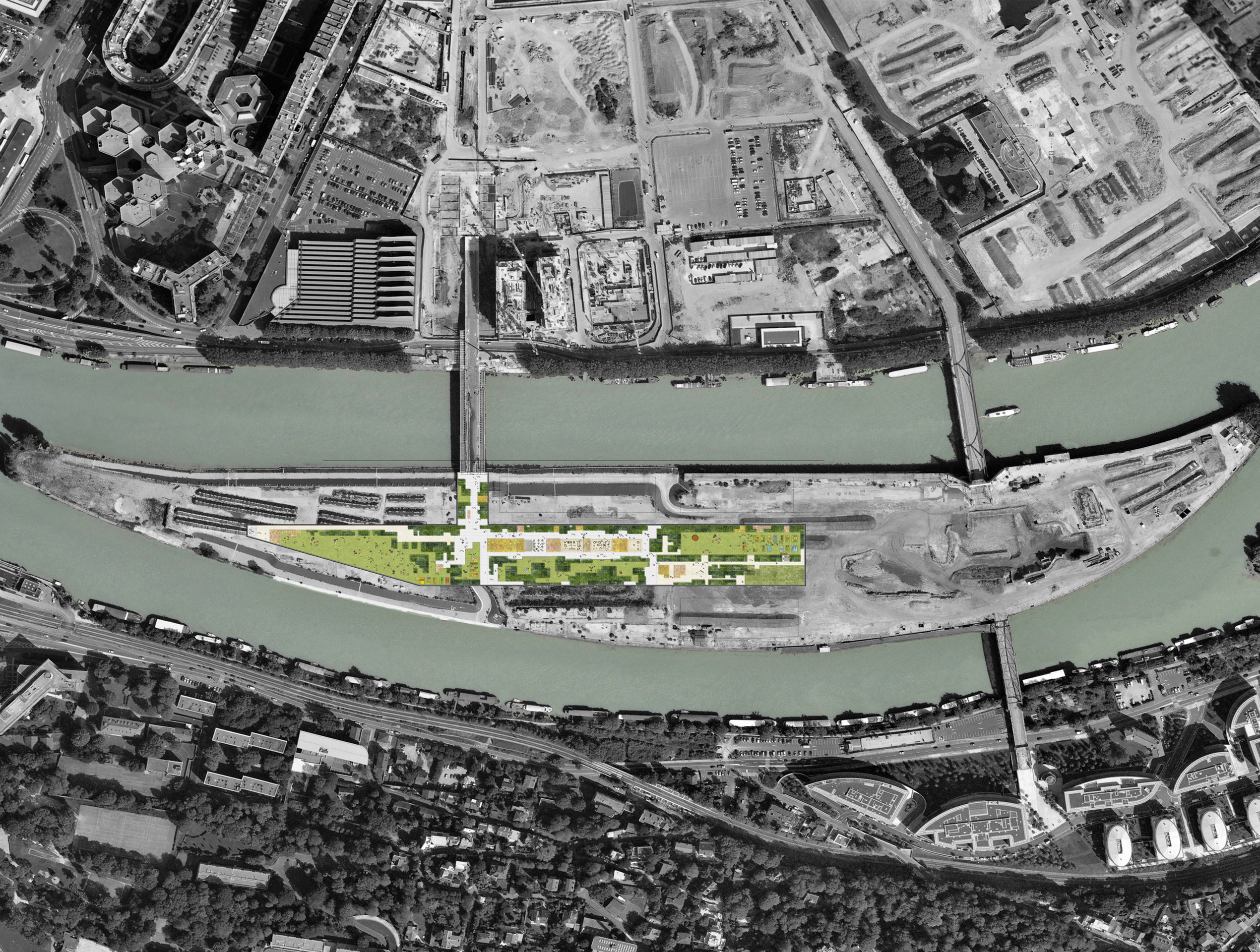
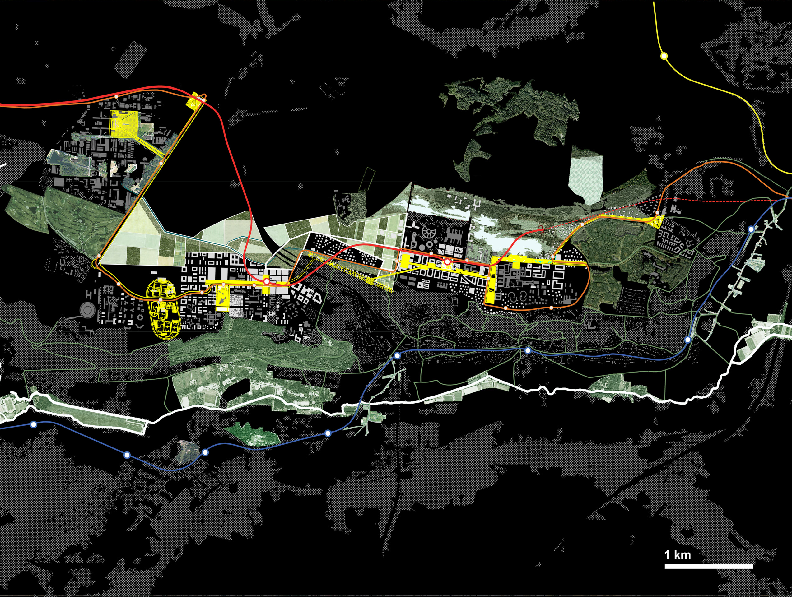
- MIchel Desvigne – PARIS-SACLAY, LISIERE – Plateau de Saclay, Esson Masterplan and section. The Saclay plateau within the geography of Grand Paris and Cross section on the edge, from left to right: the agricultural territory, the Corbeville gully (historical canal) and its overflow area, the walk planted with poplars, the orchards, the constructions. Credits Michel Desvigne Paysagiste (Lead Consultant) Xaveer de Geyter, Floris Alkemade, Architectes-Urbanistes Arep Sogreah Setec Alto Tractebel. Credit: MDP
Jordi Bellmunt
With a degree in Architecture obtained at the ETSAB of Barcelona, Jordi Bellmunt has lectured there in the Department of Urbanism and Regional Planning since 1982. Since 1987 he has been lecturing for the Masters in Landscape Architecture held at the Polytechnic University of Catalonia (UPC), of which he has been director ever since 2000. He has been the director of the Centre for Research and Projects of Barcelona landscapes of the Department of Urbanism and Regional Planning of the UPC, since 2002. He promoted the European Biennial of Landscape Architecture Barcelona, of which he supervised the first four editions. He is currently working as an architect and landscape specialist. His articles are published in various specialised magazines.
-
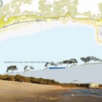
- Jordi Bellmunt – PLATJA LARGA – Salou, Tarragona, Spain, 2019 The Salou Platja Llarga project deals with the theme of Landscape in relation to Tourism. The intervention therefore concerns a transversal system, a limiting element, markedly parallel to the coast in the city of Salou about 120 km south of Barcelona, a predominantly tourist city. The waterfront is part of a global project to redefine the coast along the city of Salou, ensuring continuity and accessibility to all points of the territory. A new strategy for intervention on the coast: masterplan, section and photo. photo (on the bottom) by Lourdes Jansana In collaboration whit: N. Castaños, Jordi Samper, Joan Domingo Credit: photo by Lourdes Jansana

-
- Jordi Bellmunt – PLATJA LARGA – Salou, Tarragona, Spain, 2020 On a stretch of coast equal to about one kilometer, the arrival point of the theme park on the coast, the proposal provides for the recovery of the primeval image of the place characterized by an extremely degraded dune system due to the installation of a campsite. Photos of the project Team: N. Castaños, Jordi Samper, Joan Domingo Credits: Comune Salou, Fabrizio Gruppini and B2B Arquitectes

-
- Jordi Bellmunt – PLATJA LARGA – Salou, Tarragona, Spain, 2020 The waterfront among trees, belvedere, spaces for contemplation, meeting points, has kept as its main criterion the conservation of the natural wealth of the site, the desire to make nature feel around and convert the waterfront into a place with spatial and environmental quality. The proposal adapts to the orography of the place and its characteristics, and defines a project that is the result of dialogue and creative will together with the potential of an unusual place. Masterplan and details Team: N. Castaños, Jordi Samper, Joan Domingo
-
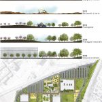
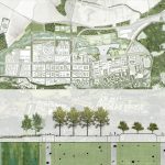
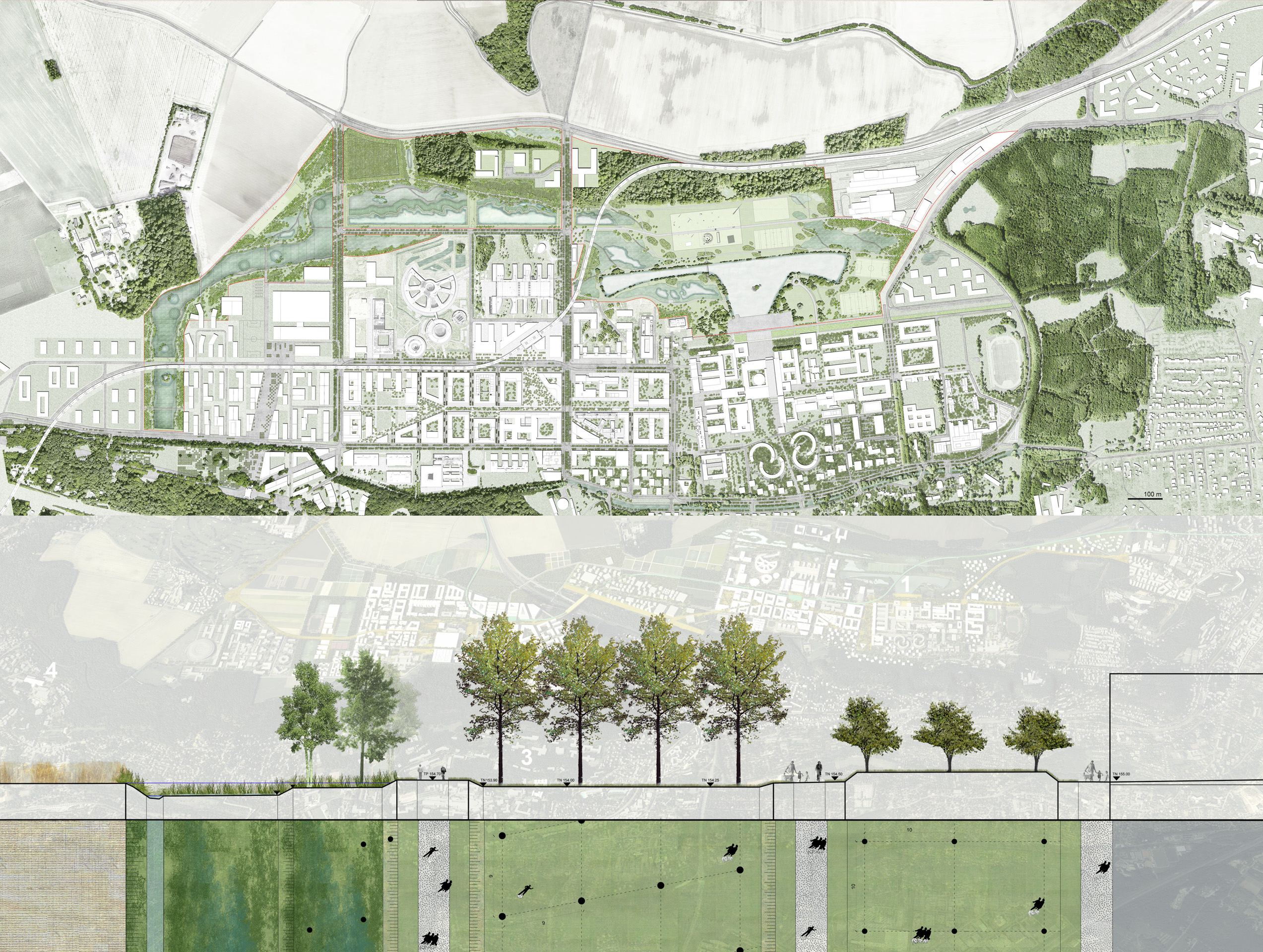
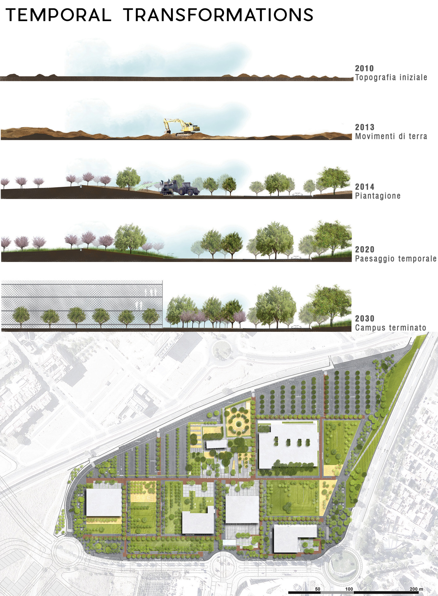
- Jordi Bellmunt – REUS CAMPUS – Reus, Spain, 2019 Following a timed implementation program, over a period of 10 years, the proposal provides for the gradual transformation of the place where university buildings and equipment will be implemented. Starting from the existing agricultural structure, a new landscape is therefore configured which will develop over time, in a sustainable and efficient way. Landscape temporal transformation ( on the top) and masterplan (on the bottom) Credits B2B Arquitects
-
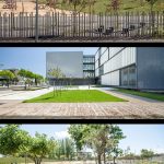
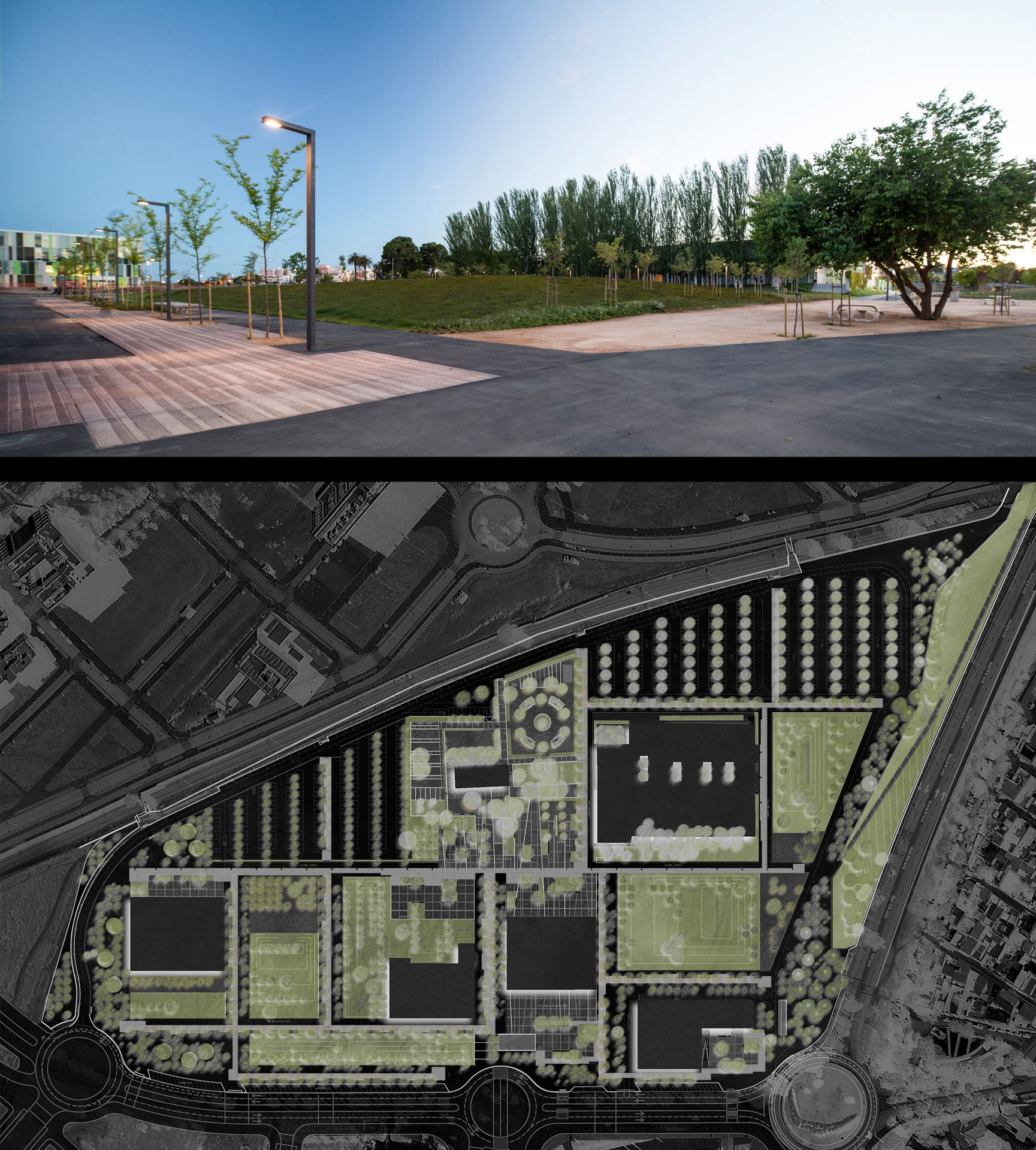
- Jordi Bellmunt – REUS CAMPUS – Reus, Spain, 2019 By recovering the identity of the place, the aim is to create a dynamic landscape, at the service of different users, which will ensure maximum comfort (behavioral and ethological) and a better interrelation between people and the surrounding environment. Photos of the project. Photos by Adrià Goula Credits B2B Arquitects

-
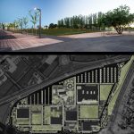
- Jordi Bellmunt – REUS CAMPUS – Reus, Spain, 2019 The university campus of Bellissens lies on the agricultural area of the old Mas Vila de Barberà farm, a historical asset of the city of Reus, currently the seat of the university’s rectorate. The landscape proposal, designed in the first phase, lays the foundations for the future urbanization of the area, according to an approach that provides for an integrated design-management-maintenance model. Photo of the project by Adrià Goula (on the top) and masterplan (on the bottom) Credits B2B Arquitects
-
- Jordi Bellmunt – SANTA COLOMA DE GRAMENET – Metropolitan Area of B These projects are an example of how small projects can improve the quality of life of many people and bring colour to places that did not expect it. Creating landscapes in a sterile medium, creating life where there is only mistrust, generating security where there is mistrust, creating joy in a sad world. Photos of the project Credits B2B Arquitectes
-
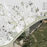
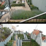
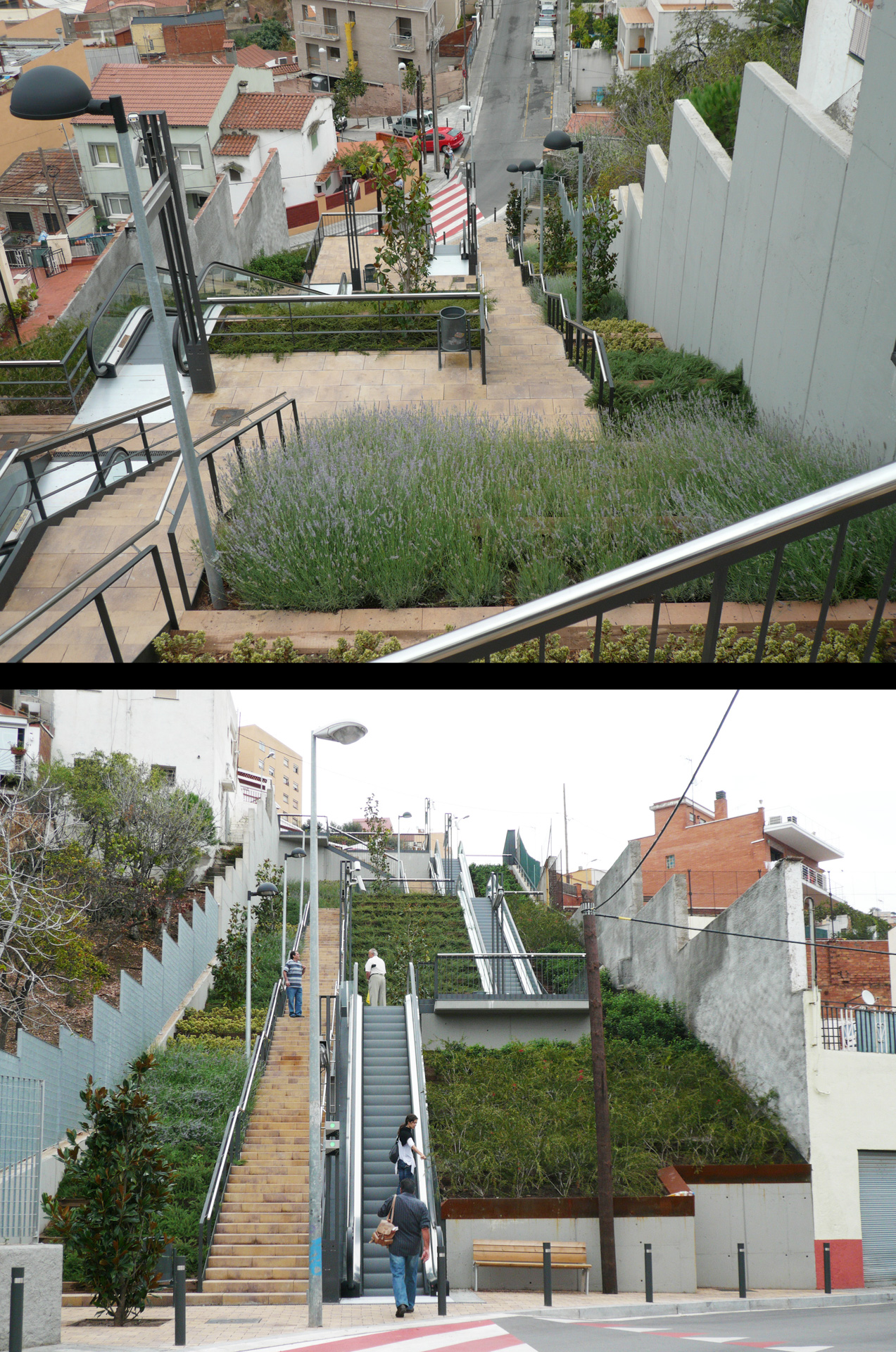
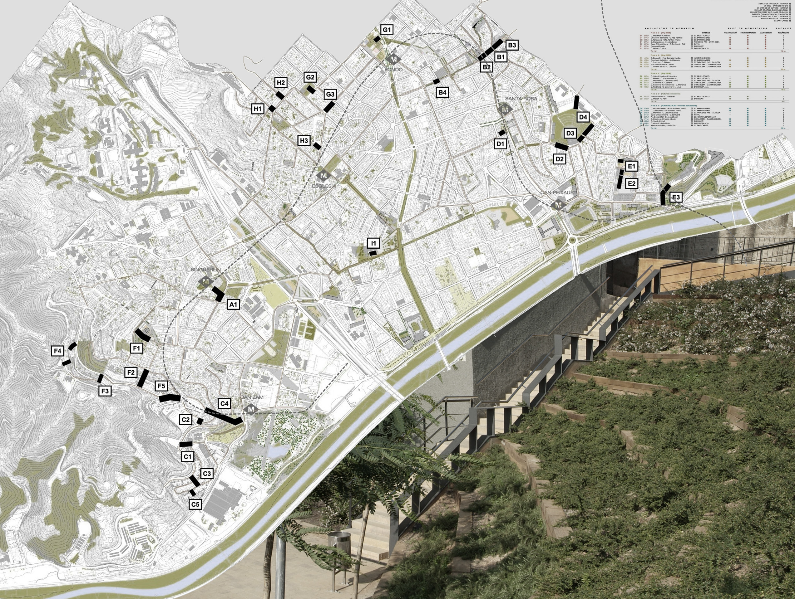
- Jordi Bellmunt – SANTA COLOMA DE GRAMENET – Metropolitan Area of B As part of the objectives of Agenda 21, the Municipality of Barcelona has planned in recent years a series of strategic actions aimed at improving pedestrian mobility from the city to the suburbs of the metropolitan area. In this line of action, the municipality of Santa Coloma has promoted the installation of elevators, escalators and mobile ramps, where the pronounced topography and an unorthodox design, have built urbanized areas with reduced pedestrian mobility and a fragmented public space. Masterplan and photo of the project B2B Arquitectes
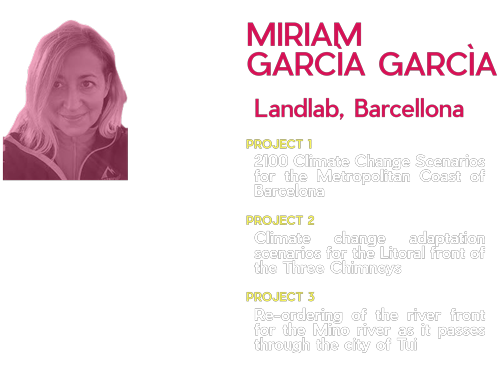
Miriam Garcìa Garcìa
PhD in Architecture, Landscape Architecture, Urban Planner, founder and Director of LAND LAB, Landscape Laboratory S.L., office based in Barcelona. She collaborates from the studio in different projects aimed at the promotion and development of spatial planning, landscape, urban design and its adaptation to climate change. Many of these works have national and international recognition such as the Prize of the XII Biennial of Spanish Architecture and Urbanism or Good Practice 2012 of the Un-Habitat Committee. In addition to this professional experience, I worked in the public administration of the Government of Cantabria, heading the Directorate General for Urban and Regional Planning, at the beginning of my professional career (2003-2007)
-

- Miriam Garcìa Garcìa – 2100 CLIMATE CHANGE SCENARIOS FOR THE METROPOLITAN COAST OF BARCELONA, 2019 Masterplan, before and after the project Credits Landlab, landescape laboratory. Coordination: Miriam Garcìa Garcìa. Team: Lena Cissé, Manuel Esteban Alvarez, Sathika Jienjaroonsri, Daniel LeBouhris, Maria Moure

-

- Miriam Garcìa Garcìa – 2100 CLIMATE CHANGE SCENARIOS FOR THE METROPOLITAN COAST OF BARCELONA, 2019 Photos of the project Credits Landlab, landescape laboratory. Coordination: Miriam Garcìa Garcìa. Team: Lena Cissé, Manuel Esteban Alvarez, Sathika Jienjaroonsri, Daniel LeBouhris, Maria Moure

-

- Miriam Garcìa Garcìa – 2100 CLIMATE CHANGE SCENARIOS FOR THE METROPOLITAN COAST OF BARCELONA, 2019 From left to right: Masterplan, Besos Before and visioning: “Aiuguamolls del besos, Marc de 2028 Credits LandLab, landscape laboratory. Coordination: Miriam Garcìa Gracìa. Team: Lena Cissé, Manuel Esteban Alvarez, Sathika Jienjaroonsri, Daniel LeBouhris, Maria Moure. Credits: LandLab

-

- Miriam Garcìa Garcìa – CLIMATE CHANGE ADAPTATION SCENARIOS FOR THE LITORAL FRONT OF THE THREE CHIMNEYS – Barcelona, 2020 A new strategy for intervention on the coast Credits Landlab, landescape laboratory. Coordination: Miriam Garcìa Garcìa. Team: Cristina Morata, Sara Ingignoli, Paola Cuitiva

-

- Miriam Garcìa Garcìa – CLIMATE CHANGE ADAPTATION SCENARIOS FOR THE LITORAL FRONT OF THE THREE CHIMNEYS – Barcelona, 2020 Renderings of the project Credits Landlab, landescape laboratory. Coordination: Miriam Garcìa Garcìa. Team: Cristina Morata, Sara Ingignoli, Paola Cuitiva

-

- Miriam Garcìa Garcìa – CLIMATE CHANGE ADAPTATION SCENARIOS FOR THE LITORAL FRONT OF THE THREE CHIMNEYS – Barcelona, 2020 From left to right: A new litoral front; Three Chimneys Coastal Front; An alternative from landscape as a resilient, ecological and social infrastructure. Credits Landlab, landescape laboratory. Coordination: Miriam Garcìa Garcìa. Team: Cristina Morata, Sara Ingignoli, Paola Cuitiva

-

- Miriam Garcìa Garcìa – RE-ORDERING OF THE RIVER FRONT FOR THE MINO RIVER AS IT PASSES THROUGH THE CITY OF TUI – Tui, Spain, 2019 Perspective: The perspective simulates the resulting landscape Credits Landlab. Coordination:Miriam García García, María Fandiño. Team: Lara del Valle, Paola Cuitiva, Valentina Piliego

-

- Miriam Garcìa Garcìa – RE-ORDERING OF THE RIVER FRONT FOR THE MINO RIVER AS IT PASSES THROUGH THE CITY OF TUI – Tui, Spain, 2019 Project Focus Credits Landlab. Coordination:Miriam García García, María Fandiño. Team: Lara del Valle, Paola Cuitiva, Valentina Piliego

-

- Miriam Garcìa Garcìa – RE-ORDERING OF THE RIVER FRONT FOR THE MINO RIVER AS IT PASSES THROUGH THE CITY OF TUI – Tui, Spain, 2019 Masterplan,cross section and visioning Credits Landlab. Coordination:Miriam García García, María Fandiño. Team: Lara del Valle, Paola Cuitiva, Valentina Piliego

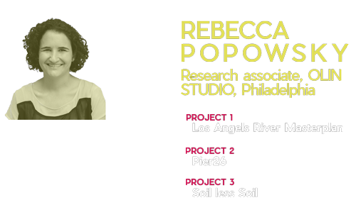
Rebecca Popowsky
PhD in Architecture, Landscape Architecture, Urban Planner, founder and Director of LAND LAB, Landscape Laboratory S.L., office based in Barcelona. She collaborates from the studio in different projects aimed at the promotion and development of spatial planning, landscape, urban design and its adaptation to climate change. Many of these works have national and international recognition such as the Prize of the XII Biennial of Spanish Architecture and Urbanism or Good Practice 2012 of the Un-Habitat Committee. In addition to this professional experience, I worked in the public administration of the Government of Cantabria, heading the Directorate General for Urban and Regional Planning, at the beginning of my professional career (2003-2007)
-
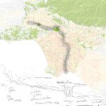
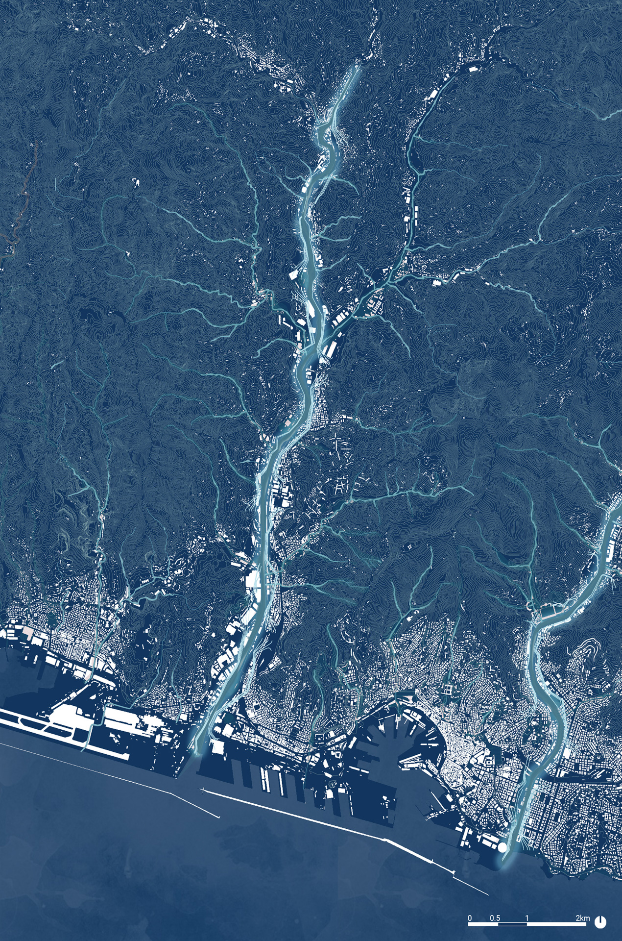
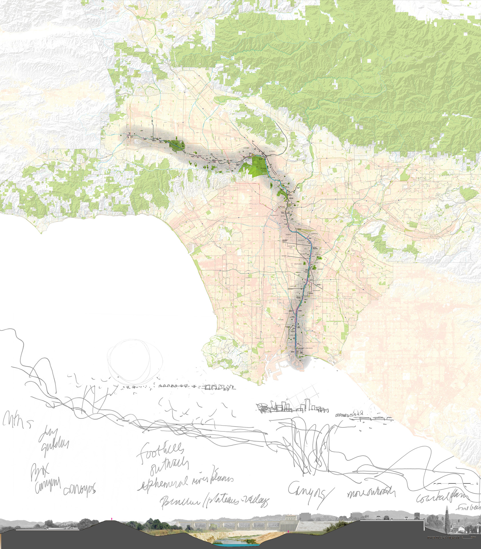
- Rebecca Popowsky Los Angeles River Masterplan – Los Angeles County, CA, on going Big Map and section.Enhancements to the LA River corridor require a fitting of community needs and opportunities with the varied conditions found along the river while not compromising the river’s role in flood risk management. The Master Plan combines many of the existing design proposals from past and ongoing planning efforts with new approaches that consider today’s unique social and environmental challenges. Credits LA River Master Plan 2020, LA County Public Works, OLIN; (sketch) Laurie Olin.
-
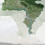
- Watershed aerial Map and section Credits LA River Master Plan 2020, LA County Public Works, OLIN
-
- Rebecca Popowsky – Los Angeles River Masterplan – Los Angeles Coun Rendering of the project Credits Credits: LA River Master Plan 2020, LA County Public Works, OLIN; (sketch) Laurie Olin.

-
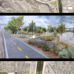
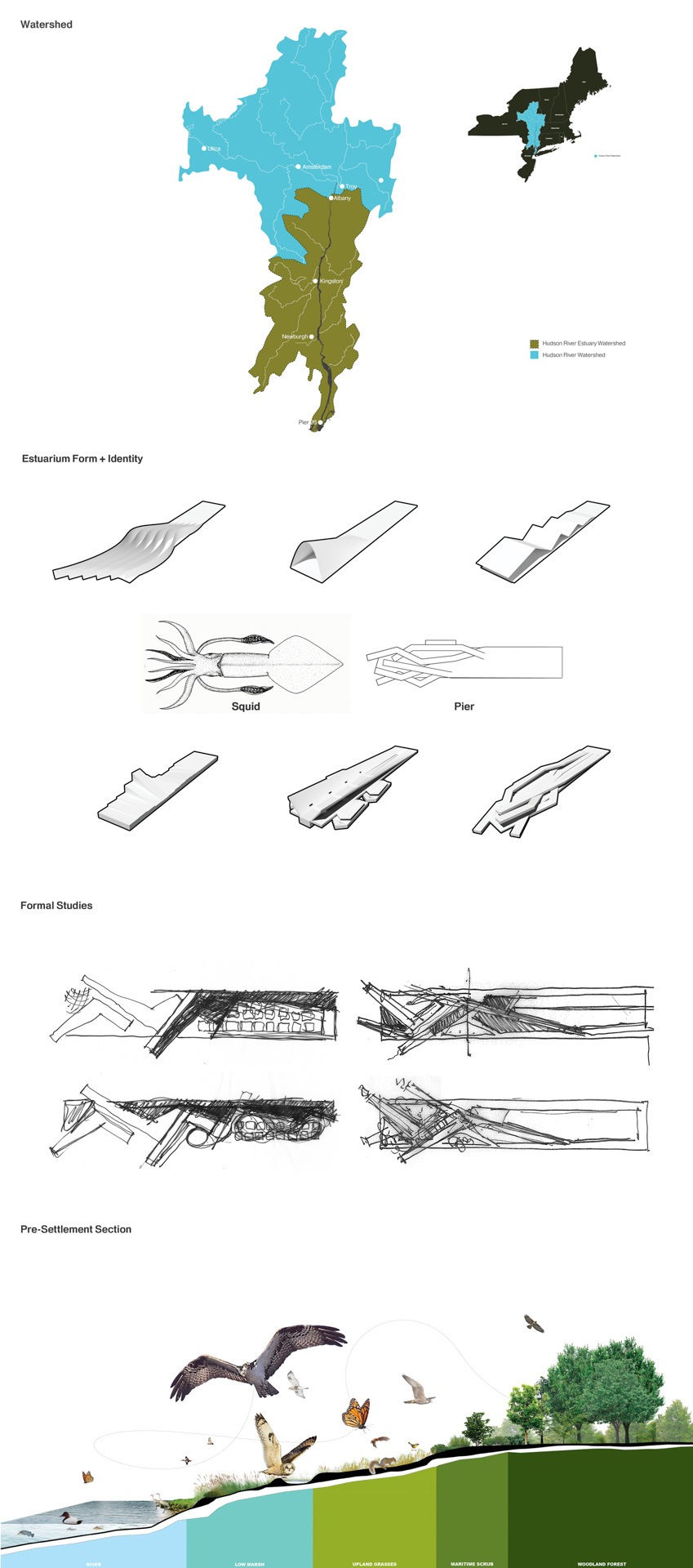
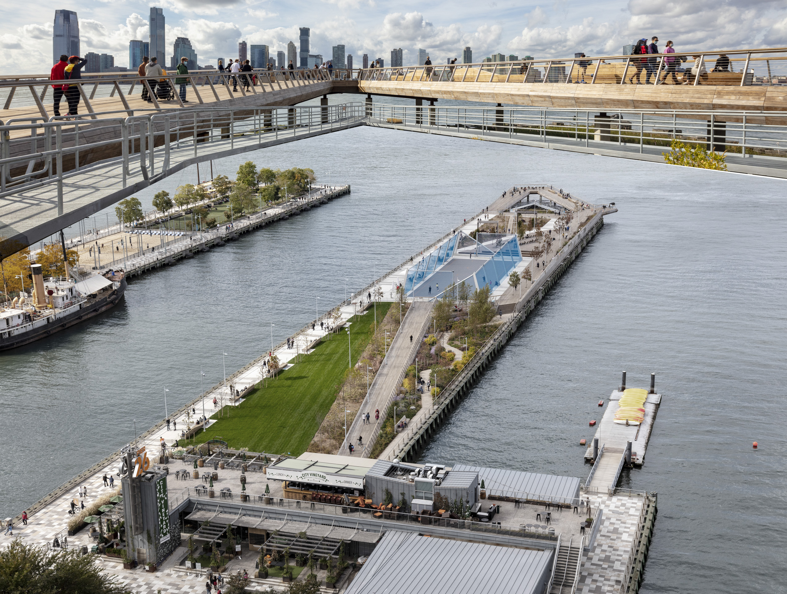
- Rebecca Popowsky PIER26 – New York, NY From up to bottom: Watershad, Estuarium form and Identity, Formal studies, Pre-settlement section. Credits OLIN STUDIO
-
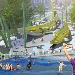
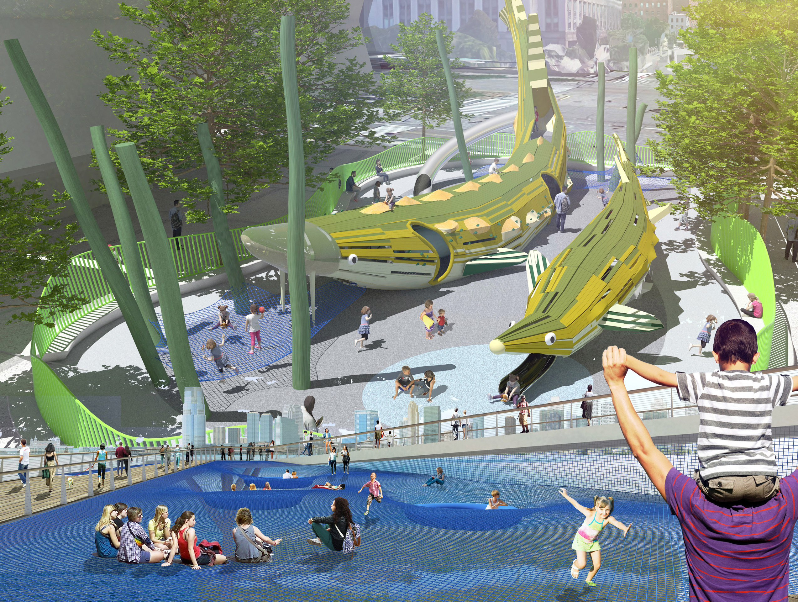
- Rebecca Popowsky PIER26 – New York, NY Rendering. From uo to bottom: Sturgeon Playscape, Play Nets Credits OLIN STUDIO
-
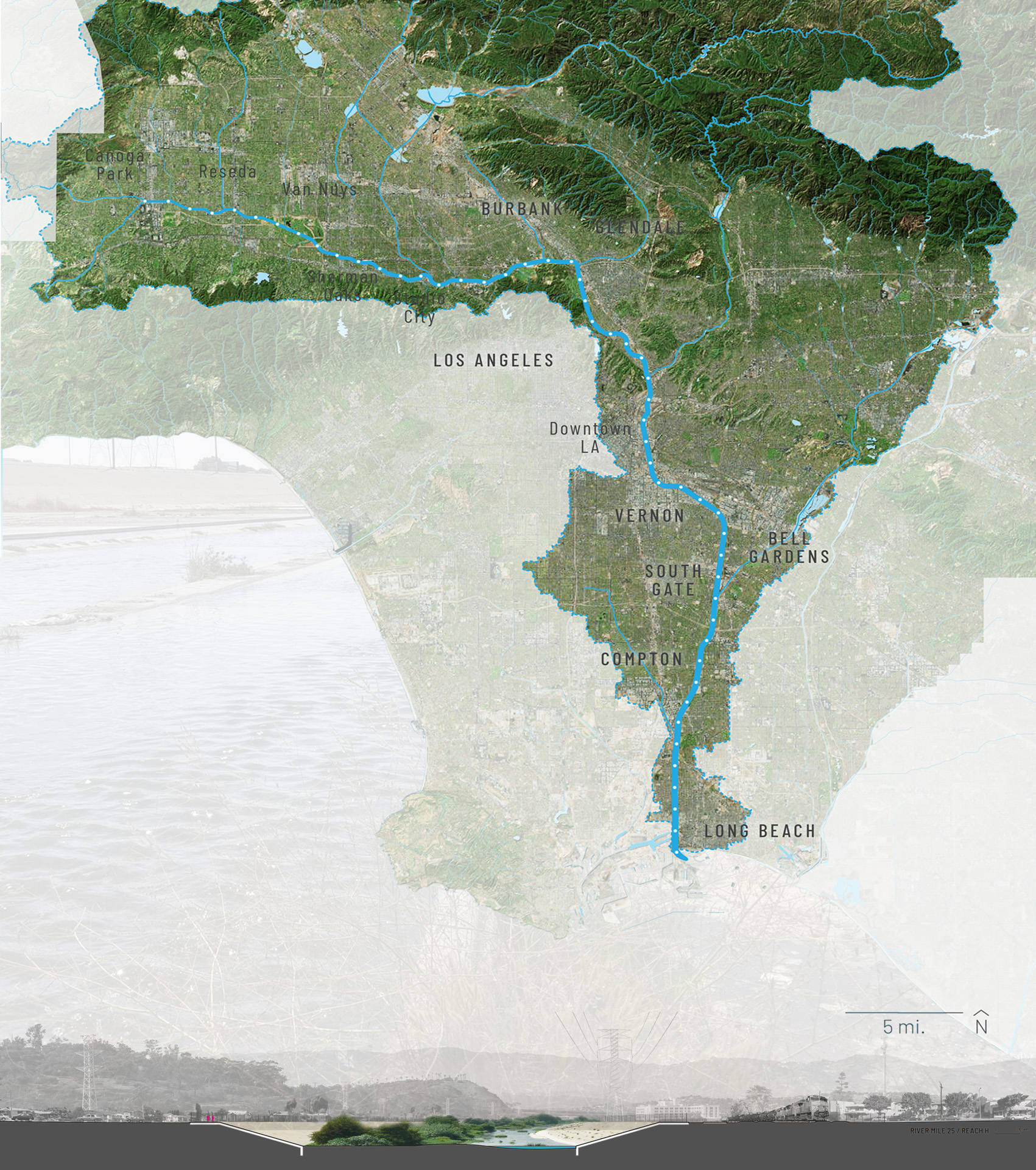
- Rebecca Popowsky PIER26 – New York, NY Photo of project. From up to bottom: Rocky Tidal Zone; Overall View OLIN STUDIO Credits: Sahar Coston-Hardy
-
- Rebecca Popowsky PIER26 – New York, NY Photo of project. From up to bottom: Woodland Forest; Coastal Grassland; Hudson River OLIN STUDIO Credits: Sahar Coston-Hardy

-
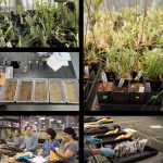
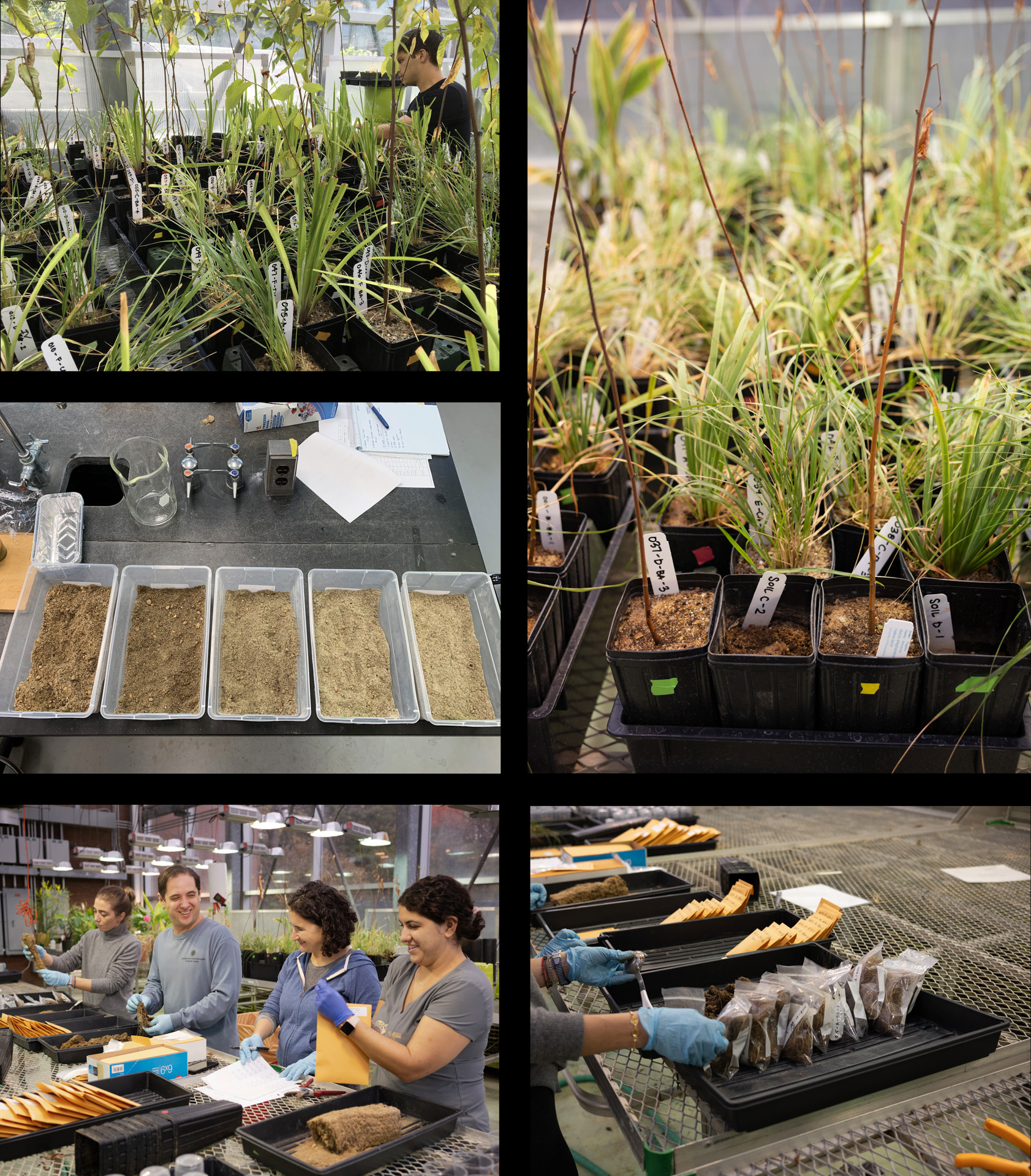
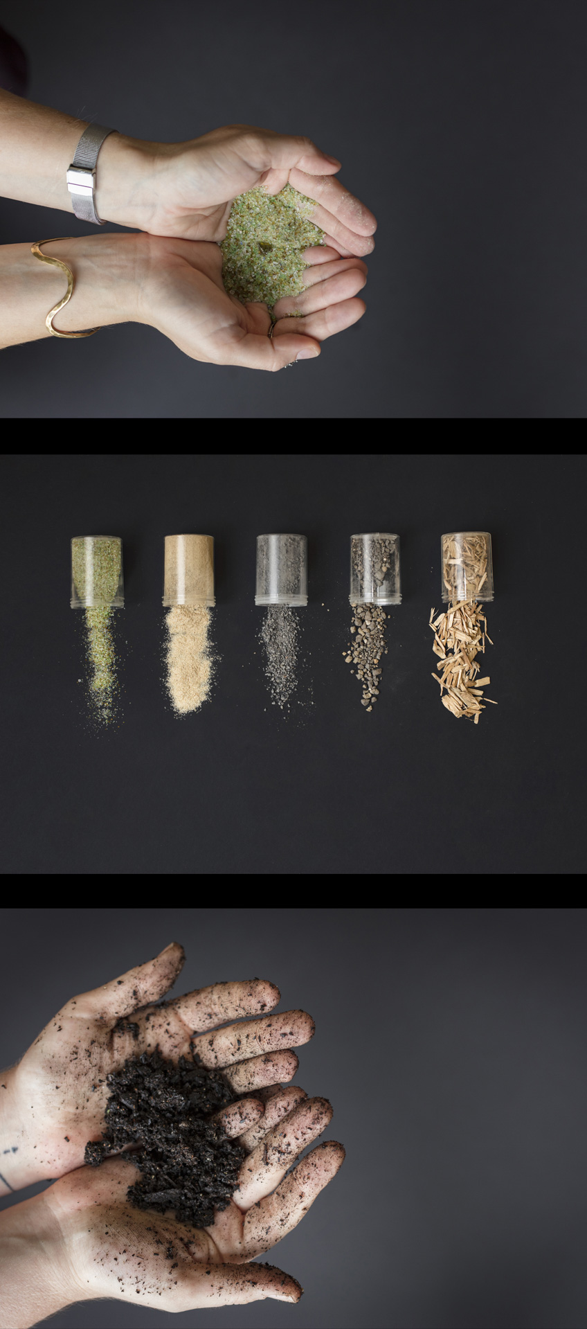
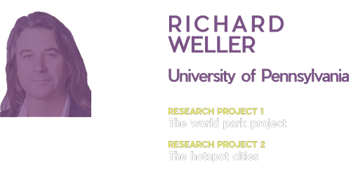
- Rebecca Popowsky SOIL LESS SOILS – Research, 2019 Greenhouse growth trial. The Soil-less Soil project aims to divert one of the region’s largest, most expensive waste streams—glass—into a rapidly reusable local component of urban soil blends. By ending the need to disruptively mine sand from pits throughout the region, this project will both close a major regional waste loop and reduce the peri-urban development pressures that accompany this extractive industries. OLIN Labs Research Initiative. Credits: OLIN
-

- Rebecca Popowsky SOIL LESS SOILS – Research, 2019 From up to bottom: Soil glass-sand, Soil mix, Soil hands. The Soil-less Soil project’s goal is to create healthy green infrastructure soils for the urban forest and parks of Philadelphia. OLIN Labs Research Initiative. Credits: Sahar Coston-Hardy
Richard Weller
Meyerson Chair of Urbanism, professor and Chair of landscape architecture, and co-executive director of The Ian L. McHarg Center for Urbanism and Ecology at the University of Pennsylvania. He is former co-director of Room 4.1.3- a design firm acknowledged with a Penn Press monograph (2005) and noted for critical design projects such as the National Museum of Australia. He is Creative Director of the award-winning LA+ Interdisciplinary Journal of Landscape Architecture.He was formerly a Winthrop Professor of Landscape Architecture at the University of Western Australia,and director of the Australian Urban Design Research Centre (AUDRC) In over 30 years of practice he has worked simultaneously as an academic and a consultant specializing in the formative stages of projects ranging from gardens to plazas, memorials, museums, suburbs and waterfronts. His research projects have involved scenario planning for cities, megaregions and nations. Weller’s work has been exhibited in galleries such as the Museum of Contemporary Art in Sydney, the Gardner Museum in Boston, the MAXXI Gallery in Rome and the Canadian Design Museum.
-
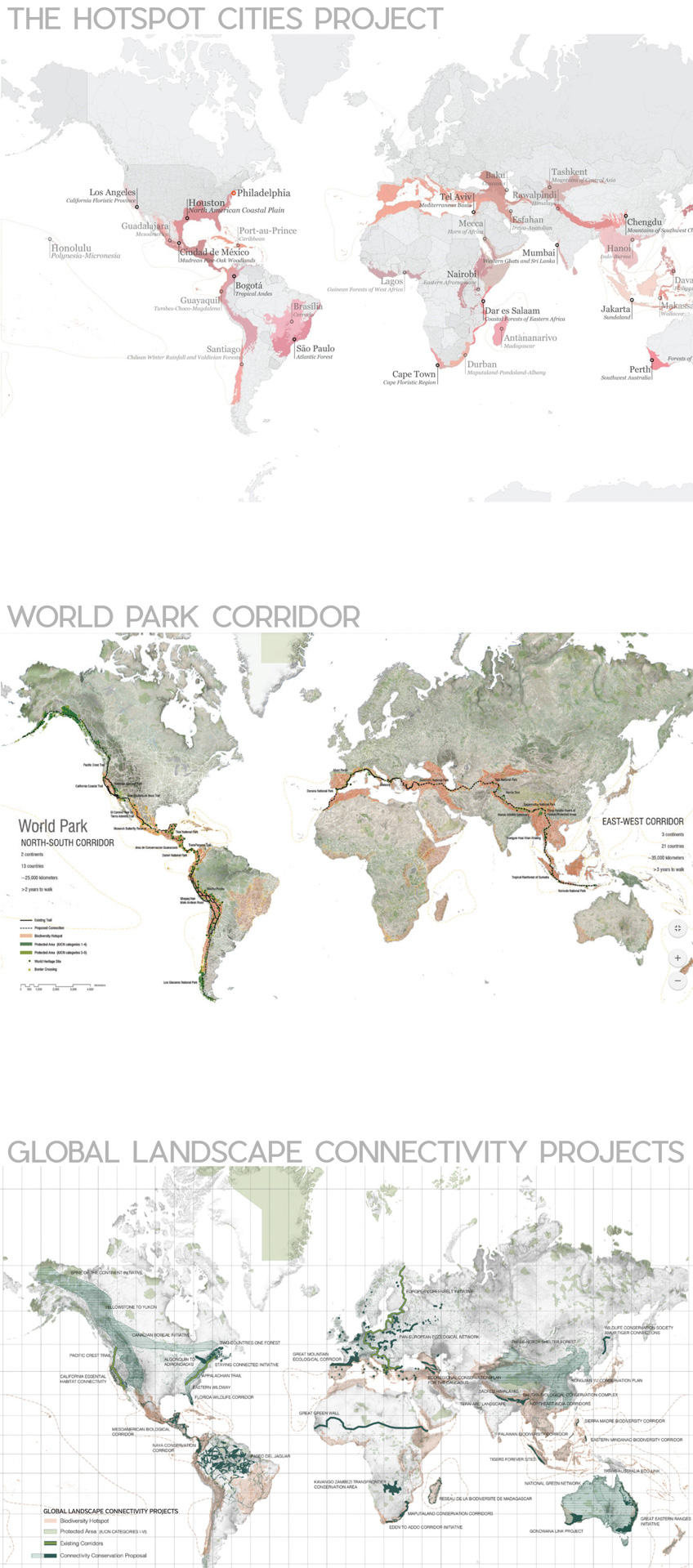
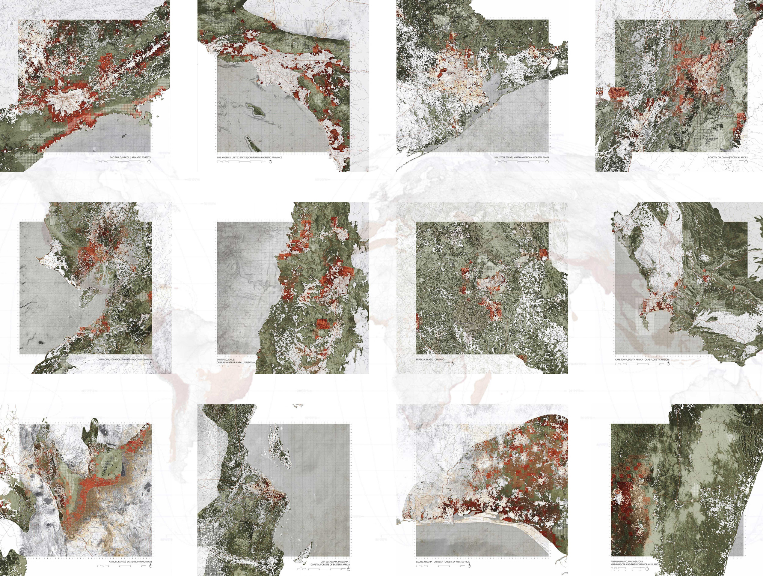
- Richard Weller – THE HOTSPOT CITIES PROJECT, 2013 – 2018 The Hotspot Cities Project is a long-term research initiative conducted through the McHarg Center and the Department of Landscape architecture at the Weitzman School of Design. Credits Team: Richard Weller Zuzanna Drozdz Chieh Huang Rebecca Popowsky David Gouverneur
-
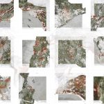
- Richard Weller – THE HOTSPOT CITIES PROJECT, 2013 – 2018 From left to right, row by row: 1)San Paulo, Brazil; 2)Los Angeles, United States; 3) Houston, Texas; 4)Bogotà, Colombia; 5)Guayaguil, Ecuador; 6) Santiago, Chile; 7)Brasilia, Brazil; 8)Cape Town, South Africa; 9)Nairobi, Kenya; 10) Dares Salaam, Tanzania; 11)Lagos, Nigeria; 12) Antananarivo, Madagascar. Credits Team: Richard Weller Zuzanna Drozdz Chieh Huang Rebecca Popowsky David Gouverneur
-
- Richard Weller – THE HOTSPOT CITIES PROJECT, 2013-2018 From left to right, row by row: 1)Mecca, Saudi Arabia; 2)Tel Aviv, Israel; 3) Esfahan, Iran; 4)Tashkent, Usbekistan 5)Rawalpindi, Pakistan; 6) Hong Kong, Shenzhen ; 7)Osaka, Kobe; 8)Honululu; United States 9)Colombo, Sri Lanka; 10) Davao,Philippines; 11)Jakarta, Indonesia; 12) Sydney, Australia. Credits Team: Richard Weller Zuzanna Drozdz Chieh Huang Rebecca Popowsky David Gouverneur

-
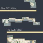
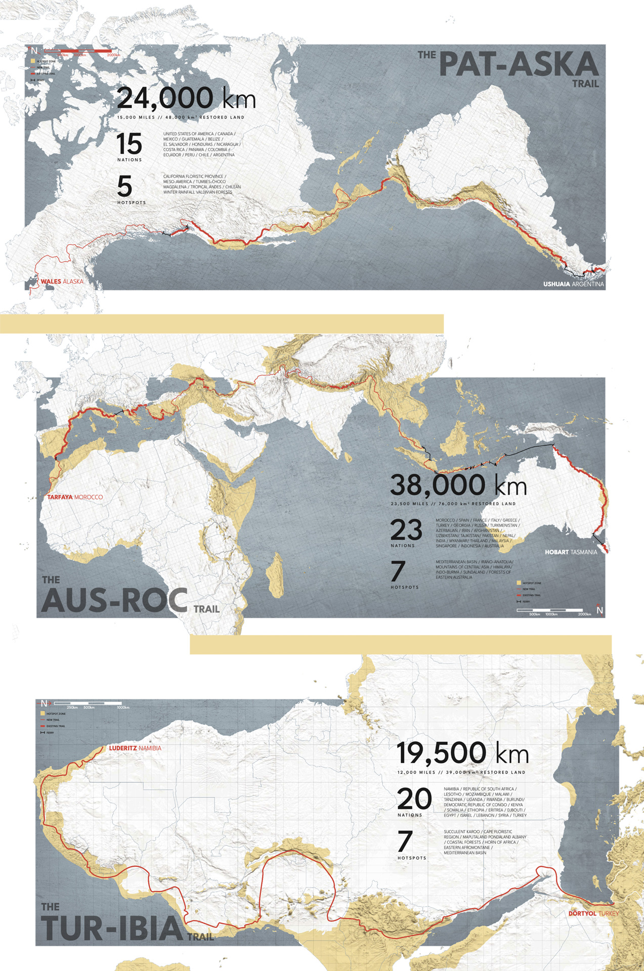
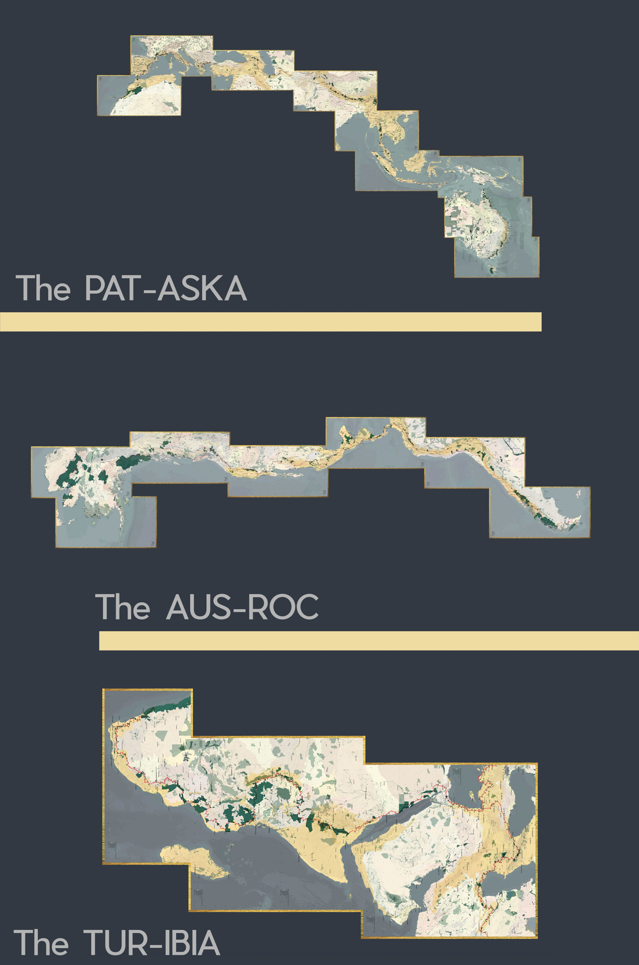
- Richard Weller – WORLD PARK PROJECT, on going The World Park has two primary tracts of land: the first runs north-south from Alaska to Patagonia, and the second, east-west from Australia to Morocco. Credits Team: Richard Weller, Clair Hoch, Madeleine Ghillany-Lehar, Alice Bell, Oliver Atwood, Elliot Bullen. Credits: Richard Weller
-
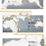
- Richard Weller – WORLD PARK PROJECT, on going The ‘World Park’ is a global initiative to ecologically restore land in the world’s biological hotspots and join these lands together into a continuous public park system. The World Park protects biodiversity, provides ecosystem services, creates jobs and offers potentially transformative personal experiences for those who work on its restoration projects or walk its trails. Credits team: Richard Weller, Clair Hoch, Madeleine Ghillany-Lehar, Alice Bell, Oliver Atwood, Elliot Bullen